2010
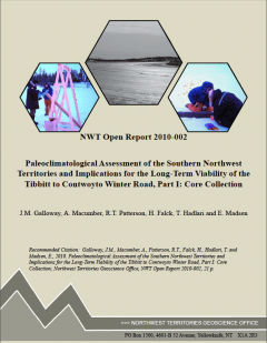 |
Contribution 121Galloway, J.M., Macumber, A., Patterson, R.T., Falck, H., Hadlari, T., Madsen, E. 2010. Paleoclimatological assessment of the southern Northwest Territories and implications for the long-term viability of the Tibbitt to Contwoyto Winter Road, Part 1: Core Collection. NWT Open Report 2010-002, 23 pages. https://doi.org/10.1016/j.quaint.2012.08.1132 |
- Read the Abstract - Contribution 121
-
Galloway, J.M., Macumber, A., Patterson, R.T., Falck, H., Hadlari, T., Madsen, E. 2010. Paleoclimatological assessment of the southern Northwest Territories and implications for the long-term viability of the Tibbitt to Contwoyto Winter Road, Part 1: Core Collection. NWT Open Report 2010-002, 23 pages. https://doi.org/10.1016/j.quaint.2012.08.1132
This pilot program is part of a larger, ongoing research program that will provide data obtained from biological and chemical analyses of lake sediments and tree rings to track climate change over the past ca. 4000 years in the southern Northwest Territories. The primary data will be complemented by traditional accounts of past climate variability. The goals of the larger project will be to increase the current understanding of natural climate variability in the southern Northwest Territories in general, and the Tibbitt to Contwoyto Winter Raod in partoicular, to increase the knowledge base required for better predictions as to how current and forecasted climate may affect the ecosystems of this region. The pilot program represents the first attempt to collect freeze cores in the southern Northwest Territories. Three freeze cores and ssociated water quality measurements were collected from Tibbitt Lake, Waite Lake, and Dome Lake, located along the TIbbitt to Contwoyto Winter Road between March 19th and March 22nd, 2009. All cores are primarily composed of mud and range in colour from black to brown. Freeze coring captured the unconsolidated seciment-water interface in two cores and it is concluded that freeze coring is an appropriate meghod for sediment core collection in northern lakes. Radiocarbon ages on bulk sediment samples from ROAD09-WAITE01 indicate that post-glacial sedimentation rates in Waite Lake are high relative to more northerly sites and confirms that high-resolution (mm scale) sub-smapling of the core will permit decada to sub-decadal analysies of lake Holocene cliamte change. The pilot program has also been successful in obtaining sediment samples form the sediment-water interface of lakes near Yellowknife. These samples were collected to develop a thecamoebian-based training set for the quantitative inference of climate parameters from fossil communities preserved in the sediments of lakes laong the Tibbitt to Conwoyto Winter Road.
 |
Contribution 120Roe, H.M., Patterson R.T., Swindles, G.T. 2010. Controls on the contemporary distribution of lake thecamoebians (testate amoebae) within the Greater Toronto Area and their potential as water quality indicators. Journal of Paleolimnology. 43: 955-975. https://doi.org/10.1007/s10933-009-9380-1 |
- Read the Abstract - Contribution 120
-
Roe, H.M., Patterson R.T., Swindles, G.T. 2010. Controls on the contemporary distribution of lake thecamoebians (testate amoebae) within the Greater Toronto Area and their potential as water quality indicators. Journal of Paleolimnology. 43: 955-975. https://doi.org/10.1007/s10933-009-9380-1
Thecamoebians were examined from 71 surface sediment samples collected from 21 lakes and ponds in the Greater Toronto Area to (1) elucidate the controls on faunal distribution in modern lake environments; and (2) to consider the utility of thecamoebians in quantitative studies of water quality change. This area was chosen because it includes a high density of kettle and other lakes which are threatened by urban development and where water quality has deteriorated locally as a result of contaminant inputs, particularly nutrients. Fifty-eight samples yielded statistically significant thecamoebian populations. The most diverse faunas (highest Shannon Diversity Index values) were recorded in lakes beyond the limits of urban development, although the faunas of all lakes showed signs of sub-optimal conditions. The assemblages were divided into five clusters using Q-mode cluster analysis, supported by Detrended Correspondence Analysis. Canonical Correspondence Analysis (CCA) was used to examine species-environment relationships and to explain the observed clusterings. Twenty-four measured environmental variables were considered, including water property attributes (e.g., pH, conductivity, dissolved oxygen), substrate characteristics, sedimentbased phosphorus (Olsen P) and 11 environmentally available metals. The thecamoebian assemblages showed a strong association with phosphorus, reflecting the eutrophic status of many of the lakes, and locally to elevated conductivity measurements, which appear to reflect road salt inputs associated with winter de-icing operations. Substrate characteristics, total organic carbon and metal contaminants (particularly Cu and Mg) also influenced the faunas of some samples. A series of partial CCAs show that of the measured variables, sedimentary phosphorus has the largest influence on assemblage distribution, explaining 6.98% (P\0.002) of the total variance. A transfer function was developed for sedimentary phosphorus (Olsen P) using 58 samples from 15 of the studied lakes. The best performing model was based on weighted averaging with inverse deshrinking (WA Inv, rjack 2 = 0.33, RMSEP =102.65 ppm). This model was applied to a small modern thecamoebian dataset from a eutrophic lake in northern Ontario to predict phosphorus and performed satisfactorily. This preliminary study confirms that thecamoebians have considerable potential as quantitative water quality indicators in urbanising regions, particularly in areas influenced by nutrient inputs and road salts.
 |
Contribution 119Galloway, J.M., Babalola, L.O., Patterson R.T., Roe, H.M. 2010. A high resolution marine palynological record from the central mainland coast of British Columbia, Canada: evidence for a mid-late Holocene dry climate interval. Marine Micropaleontology. 75:62-78. doi:10.1016/j.marmicro.2010.03.001 |
- Read the Abstract - Contribution 119
-
Galloway, J.M., Babalola, L.O., Patterson R.T., Roe, H.M. 2010. A high resolution marine palynological record from the central mainland coast of British Columbia, Canada: evidence for a mid-late Holocene dry climate interval. Marine Micropaleontology. 75:62-78. doi:10.1016/j.marmicro.2010.03.001
Sediments collected in a 12-m long core (VEC02A04) obtained from Frederick Sound in the Seymour-Belize Inlet complex of British Columbia were deposited between ca. 4540 cal. yr BP and ca. 1090 cal. yr BP in primarily dysoxic conditions. The sediments are characterized by alternating intervals of fine grained massive and laminated units. Laminated sediments consist of light-coloured diatom rich layers deposited during summer and dark-coloured mineral rich layers deposited during winter. Laminated sediments are most common in portions of the core deposited between ca. 2840 cal. yr BP and ca. 1820 cal. yr BP, and correspond to a decline in the relative abundance and pollen accumulation rate of Cupressaceae pollen between ca. 3190 cal. yr BP and ca. 2250 cal. yr BP. The preservation of laminated units and decline of Cupressaceae pollen at this time suggest that a drier and possibly cooler climate punctuated otherwise wet and temperate late Holocene conditions in the Seymour-Belize Inlet complex. We correlate the occurrence of the mid-late Holocene dry climate interval documented in Frederick Sound to dynamics in the relative position and intensity of the Aleutian Low pressure system and suggest that climate change associated with dynamics of this semi-permanent air mass affected primary productivity and vegetation of the Seymour-Belize Inlet complex.
 |
Contribution 118Patterson, R.T. 2010. Moncharmontzeiana: new name for Pytine Moncharmont Zei and Sgarella, 1978 non Fortey, 1975. Palaeontologia Electronica 13.2.10A, 2 p. |
- Read the Abstract - Contribution 118
-
Patterson, R.T. 2010. Moncharmontzeiana: new name for Pytine Moncharmont Zei and Sgarella, 1978 non Fortey, 1975. Palaeontologia Electronica 13.2.10A, 2 p.
The foraminifer Pytine Moncharmont Zei and Sgarella, 1978 is a homonym of the trilobite genus PytineFortey, 1975. Moncharmontzeiana is proposed as a replacement name for the foraminiferal genus.
 |
Contribution 117Patterson, R.T., Haggart, J.W., Dalby, AP. 2010. A guide to Late Albian-Cenomanian (Cretaceous) foraminifera from the Queen Charlotte Islands, British Columbia. Palaeontologia Electronica 13.2.12A 28 p. https://doi.org/10.4095/208599 |
- Read the Abstract - Contribution 117
-
Patterson, R.T., Haggart, J.W., Dalby, AP. 2010. A guide to Late Albian-Cenomanian (Cretaceous) foraminifera from the Queen Charlotte Islands, British Columbia. Palaeontologia Electronica 13.2.12A 28 p. https://doi.org/10.4095/208599
A systematic treatment of 57 species of Late Albian-Cenomanian (Cretaceous) foraminifera obtained from 267 samples collected from 20 localities throughout the Queen Charlotte Islands of British Columbia is presented to provide a reference aid for future researchers in the area. The benthic fauna is comprised of 35 agglutinated and 19 calcareous foraminiferal species. In addition three planktic foraminiferal species are recognized.
2009
 |
Contribution 116Riveiros-Vázquez, N., Patterson R.T. 2009. Late Holocene paleoceanographic evidence of the influence of the Aleutian Low and North Pacific High on circulation in the Seymour-Belize Inlet Complex, British Columbia, Canada. Quaternary Science Reviews 28 (25,26): 2833-2850. https://doi.org/10.1016/j.quascirev.2009.07.015 |
- Read the Abstract - Contribution 116
-
Riveiros-Vázquez, N., Patterson R.T. 2009. Late Holocene paleoceanographic evidence of the influence of the Aleutian Low and North Pacific High on circulation in the Seymour-Belize Inlet Complex, British Columbia, Canada. Quaternary Science Reviews 28 (25,26): 2833-2850.
Foraminiferal and thecamoebian faunas from the Seymour-Belize Inlet Complex (SBIC), a fjord network situated on the mainland coast of British Columbia, were studied to assess climatic cycles and trends impacting the area through the ~ AD 850–AD 2002 interval. Ocean circulation patterns prevalent in the SBIC are strongly linked to precipitation, which is closely linked to the relative strength and position (center of action; COA) of the seasonally developed Aleutian Low (AL) and North Pacific High (NPH) atmospheric circulation gyres.
Through interpretation of cluster analysis and ordination methods, a period of weak estuarine circulation was recognized to have impacted the SBIC area between ~ AD 850 and AD 1500. During this time waters in the SBIC were dysoxic to anoxic and the sediment–water interface was comprised of a depauperate foraminiferal fauna consisting of low diversity agglutinated forms. These reduced oxygen conditions came about as a result of diminished precipitation in the SBIC catchment as the COA of the AL progressively migrated westward over time, resulting in greatly reduced estuarine circulation and only infrequent and feeble incursions of well oxygenated open ocean water into the SBIC basin. By ~AD 1575, following a gradual transition period of ~75 years when circulation patterns in the inlet were unstable, very strong estuarine circulation developed in the SBIC, concomitant with the onset of the Little Ice Age (LIA) in western Canada. In the SBIC this interval was characterized by higher levels of precipitation, which greatly enhanced estuarine circulation resulting in frequent incursions of cold, well oxygenated ocean currents into the bottom waters of the SBIC and the development of a diverse calcareous fora- miniferal fauna. This circulation pattern began to break down in the late 19th century AD and by ~AD 1940 conditions similar to those that existed in the inlet prior to ~AD 1500 had redeveloped, a process that continues at present.
Contribution 115
Dalby, A.P., Patterson R.T., Haggart, J.W. 2009. Distribution of Albian-Cenomanian foraminifera from Queen Charlotte Islands, British Columbia, Canada: Constraints on the timing of the northward movement of the Wrangellia Terrane. Journal of Foraminiferal Research 39 (3): 231-245. https://doi.org/10.2113/gsjfr.39.3.231
- Read the Abstract - Contribution 115
-
Dalby, A.P., Patterson R.T., Haggart, J.W. 2009. Distribution of Albian-Cenomanian foraminifera from Queen Charlotte Islands, British Columbia, Canada: Constraints on the timing of the northward movement of the Wrangellia Terrane. Journal of Foraminiferal Research 39 (3): 231-245. https://doi.org/10.2113/gsjfr.39.3.231
This is the first major survey of the Cretaceous foraminifera of the Queen Charlotte Islands (QCI), British Columbia, Canada. Fifty-seven species of benthic and planktic foraminifera are identified in 267 samples collected from mudstones of the Albian-Cenomanian (Cretaceous) Haida and Bearskin Bay formations of the Queen Charlotte Group on Moresby and Graham islands within the QCI, British Columbia, Canada. Most of the fauna characterizes shallow-shelf environments, but outer-shelf assemblages of Cenomanian age occur at one station on northwest Graham Island where the lower part of the section appears to have been deposited during an early transgressive phase corresponding to the Greenhorn marine cycle of the North American Western Interior.
Nearly 60% of the identified foraminiferal species have affinities with Albian-Cenomanian foraminifera from Alaska. This correlation indicates that the northward drift of Wrangellia terrane, which includes the QCI, had entered the boreal realm much earlier than previously suggested by some research results.
Contribution 114
Galloway, J.M., Patterson, R.T., Doherty, C.T. and Roe, H.M. 2009. Post-glacial vegetation and climate dynamics at Tiny Lake, central mainland coast of British Columbia. Journal of Quaternary Science 24 (4): 322-335. DOI: 10.1002/jqs.1232.
- Read the Abstract - Contribution 114
-
Galloway, J.M., Patterson, R.T., Doherty, C.T. and Roe, H.M. 2009. Post-glacial vegetation and climate dynamics at Tiny Lake, central mainland coast of British Columbia. Journal of Quaternary Science 24 (4): 322-335. DOI: 10.1002/jqs.1232.
A pollen-based study from Tiny Lake in the Seymour-Belize Inlet Complex of central coastal British Columbia, Canada, permits an evaluation of the dynamic response of coastal temperate rainforests to postglacial climate change. Open Pinus parklands grew at the site during the early Lateglacial when the climate was cool and dry, but more humid conditions in the later phases of the Lateglacial permitted mesophytic conifers to colonise the region. Early Holocene conditions were warmer than present and a successional mosaic of Tsuga heterophylla and Alnus occurred at Tiny Lake. Climate cooling and moistening at 8740 ± 70 14C a BP initiated the development of closed, late successional T. heterophylla-Cupressaceae forests, which achieved modern character after 6860 ± 50 14C a BP, when a temperate and very wet climate became established. The onset of early Holocene climate cooling and moistening at Tiny Lake may have preceded change at more southern locations, including within the Seymour-Belize Inlet Complex, on a meso- to synoptic scale. This would suggest that an early Holocene intensification of the Aleutian Low pressure system was an important influence on forest dynamics in the Seymour-Belize Inlet Complex and that the study region was located near the southern extent of immediate influence of this semi-permanent air mass.
Contribution 113
Roe, H.M., Doherty, C.T., Patterson, R.T., Swindles, G.T. 2009. Contemporary distributions of saltmarsh diatoms in the Seymour–Belize Inlet Complex, British Columbia, Canada: Implications for studies of sea-level change, Marine Micropaleontology. 70 (3,4): 134-150. https://doi.org/10.1016/j.marmicro.2008.12.001
- Read the Abstract - Contribution 113
-
Roe, H.M., Doherty, C.T., Patterson, R.T., Swindles, G.T. 2009. Contemporary distributions of saltmarsh diatoms in the Seymour–Belize Inlet Complex, British Columbia, Canada: Implications for studies of sea-level change, Marine Micropaleontology. 70 (3,4): 134-150. https://doi.org/10.1016/j.marmicro.2008.12.001
Surface diatom samples were collected from two saltmarshes in the Seymour–Belize Inlet Complex on the mainland coast of British Columbia to examine the controls on diatom distribution and provide training sets for regional studies of sea-level change. Cluster analysis and detrended correspondence analysis (DCA) were used to examine diatom distributions within and between the two marshes whilst canonical correspondence analysis (CCA) and partial canonical correspondence analysis (pCCA) were used to analyse species–environment relationships. The diatom assemblages were shown to be quite different between the two marshes, Waump and Wawwat’l. Q-mode cluster analysis separated the diatom assemblages from Waump into three zones corresponding to recognized vegetation zones; diatom zone C corresponds to the high marsh and is dominated by Pinnularia obscura, Caloneis bacillum and Diploneis ovalis, zone B spans the high- and mid marsh and is characterised by Fragilaria exigua, Nitzchia palea and D. ovalis, whilst zone A from the low marsh tidal flat includes high frequencies of Diploneis smithii, Ctenophora pulchella and F. exigua. Three different diatom zones were recognised at Wawwat’l; two upper zones, E and F, corresponding to the mid-marsh which are dominated by mixed abundances of N. palea and Fragilaria construens var. venter, Navicula peregrina and Navicula clementis and zone D from the low marsh tidal flat with increased frequencies of F. exigua and Achnanthes delicatula. At Waump, the major controls on diatom distribution were found to be elevation and to a lesser extent pH, whilst atWawwat’l, the primary controls were grain size/organic content, conductivity and elevation. The results confirm that saltmarsh diatoms may have potential for future sea-level studies in this region. However, caution must be exercised as the significant difference in the diatom assemblages between the two marshes suggests that the diatoms are responding to a number of environmental variables on a local scale. Some of this variation may reflect highly seasonal changes in sedimentation and salinity resulting from the proximity of the marshes to adjacent streams which are subject to spring freshet. Local differences in elevation between the collected samples may also account for some of the assemblage variability. The results emphasize the great diversity and high sensitivity of intertidal diatom species to environmental controls.

Contribution 112
Abbott, P.L., Samson, C., Sutherland, S., Phillips, D., Patterson, R.T. , MacEachern, F., Martell, D. 2009. Natural Disasters, 1st Cdn edition McGraw-Hill Ryerson. ISBN-13: 9780070980372 (ISBN-10: 0070980373), 1st Edition, 512 pages, Softcover.
- Read the Abstract - Contribution 112
-
>Abbott, P.L., Samson, C., Sutherland, S., Phillips, D., Patterson, R.T. , MacEachern, F., Martell, D. 2009. Natural Disasters, 1st Cdn edition McGraw-Hill Ryerson. ISBN-13: 9780070980372 (ISBN-10: 0070980373), 1st Edition, 512 pages, Softcover.
This book focuses on natural disasters: how the normal processes of the Earth concentrate their energies and deal heavy blows to humans and their structures. It is concerned with how the natural world operates and, in so doing, kills and maims humans and destroys their works. Throughout the book, certain themes are maintained:’Energy sources underlying disasters; Plate tectonics and climate change; Earth processes operating in rock, water, and atmosphere; Significance of geologic time; Complexities of multiple variables operating simultaneously; Detailed and readable case histories.
New Features :
* Experts in the Field: Abbott covers the most significant natural hazards from geologic to atmospheric, and even the impact of space debris, as well as their associated phenomena. The comprehensive coverage of natural disaster topics allows the instructor to selectively pick and choose those chapters that cover their specific interests. For the Canadian edition, we have hired experts in the field to adapt four chapters: Chapter 10: Atmosphere, Oceans, and Long-Term Climate Change (Tim Patterson/Carleton University) Chapter 11: Short-Term Climate Change and Severe Weather Chapter (David Phillips/Environment Canada) 14: Fire (David Martell/UToronto) Chapter 15: The Great Dyings (Fiona MacEachern & Stuart Sutherland UBC) This ensures that Natural Disasters 1CE has the most accurate and timely coverage possible.
* Virtual Vistas: Found on the OLC, Virtual Vistas recap what students have learned in each chapter and provide a visual to explain the topic. Students are then able to view a video related to the chapter topic and respond to several questions.
* Quality four-colour art program: The author has added an astonishing 300 new images, including 150 new photos and close to 40 new maps, for the Canadian edition, making this a visually stunning text. Through the Digital Content Manager, instructors will have access to all photos and line art in the text.
* Case Histories: The Canadian edition includes case histories to explain important principles about the Earth and then further develops understanding through numerous case studies.
* Theme: The hidden theme to Abbott is ‘Geology in Your Life.’ The Canadian edition shows examples of how natural disasters affect people (with a special emphasis on Canada and Canadians), and why we need to prepare for them in our daily lives. Competitive texts are weak in providing solid examples and have an environmental geology focus.
2008
Contribution 111
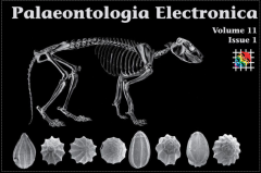
Vázquez-Riveiros, N. and Patterson, R.T. 2008. Foraminifera from the Seymour-Belize Inlet Complex, northern British Columbia, Canada. Palaeontologia Electronica, 11.1.2A, 45 p. https://doi.org/10.22215/etd/2006-10712
- Read the Abstract - Contribution 111
-
Vázquez-Riveiros and Patterson. 2008. Foraminifera from the Seymour-Belize Inlet Complex, northern British Columbia, Canada. Palaeontologia Electronica, 11.1.2A 45 p. https://doi.org/10.22215/etd/2006-10712
Detailed taxonomic descriptions and illustrations of 94 foraminiferal species found in the Seymour-Belize Inlet Complex (SBIC), a fjord network situated on the north coast of British Columbia, are presented as an aid to future researchers. This treatment includes a few planktic foraminiferal taxa that carried into the SBIC from the open ocean. In addition, ten freshwater thecamoebian species that were washed into the inlet from the nearby adjacent shore are also described.

Contribution 110
Watchorn, M.A., Hamilton, P.B., Anderson, T., Roe, H.M., Patterson, R.T. 2008 Diatoms and pollen as indicators of water quality and land use change: a case study from the Oak Ridges Moraine, Southern Ontario. Journal of Paleolimnology 39: 491-509.https://doi.org/10.1007/s10933-007-9126-x
- Read the Abstract - Contribution 110
-
Watchorn, M.A., Hamilton, P.B., Anderson, T., Roe, H.M., Patterson, R.T. 2008 Diatoms and pollen as indicators of water quality and land use change: a case study from the Oak Ridges Moraine, Southern Ontario. Journal of Paleolimnology 39: 491-509.https://doi.org/10.1007/s10933-007-9126-x
Swan Lake is a small kettle lake located on the Oak Ridges Moraine; a moraine that is recognized as an important source of ground water for the nearby and rapidly expanding Greater Toronto Area. A paleolimnological reconstruction using pollen and diatoms from the lake sediments showed significant changes in biological community composition through the last ~400 years. Alterations in the diatom and pollen assemblages were most dramatic ca. A.D. 1850, correlating with the highest sediment flux in the lake between the period ca. A.D. 1850 and A.D. 1870. These changes were directly linked to regional deforestation and agricultural activities associated with European settlement. The pollen record from ca. A.D. 1850 to present day indicated that tree species (e.g. Pinus spp., Tsuga canadensis) were declining, while grass (Poaceae) and invasive species (e.g. Ambrosia) were increasing. Around A.D. 1850, the diatom flora changed from an assemblage dominated by large, benthic species (e.g. Sellaphora pupula, Pinnularia cf. maior, and Stauroneis phoenicenteron) to an assemblage characterized by smaller, tychoplanktonic (e.g. Fragilaria tenera, Staurosirella pinnata) and epiphytic (e.g. Achnanthidium minutissimum, Rossithidium linearis) taxa. This diatom community change supports the intermediate disturbance hypothesis which predicts a high level of diversity and richness following an intermediate to intense disturbance of short duration. Phosphorus concentrations in Swan Lake were inferred using a diatom-based regional calibration model, and the results indicated marked changes in lake water chemistry through time (from below detection limits before land clearance and settlement to 19.3 mg 1-1 in the current sediments), which were concurrent with episodes of regional deforestation and land-use change. Although the sediment and biological records indicate that the lake ecology has stabilized over the last 30–50 years, paleolimnological records show that the water quality and biology of Swan Lake has changed dramatically and not returned to pre-settlement conditions. Swan Lake presents a detailed record of the impact created by deforestation and urban development with a population of <50 individuals per km2. Detailed paleolimnological studies like Swan Lake, in tandem with global human footprint studies, can create realistic estimates of land-use impacts at the global scale.
Share: Twitter, Facebook
Short URL: https://carleton.ca/timpatterson/?p=1341Search