2019
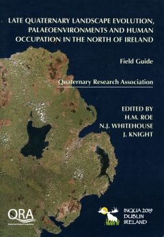 |
Contribution 177Roe, H.M., Swindles, G.T., Patterson, R.T. 2019. Post glacial relative sea-level history of Glenariff, Glens of Antrim. In H.M. Roe, N.J. Whitehouse, J.K. Knight (eds). Late Quaternary Landscapte Evolution, Palaeoenvironments and Human Occupation of the North of Ireland. Field Guide. Quaternary Research Association. p. 138-148, ISSN 0 261 36611; ISBN 0 9077 80 911Read the PDF |
- Read the Abstract - Contribution 177
-
Roe et al. 2019. Post glacial relative sea-level history of Glenariff, Glens of Antrim. In H.M. Roe, N.J. Whitehouse, J.K. Knight (eds). Late Quaternary Landscapte Evolution, Palaeoenvironments and Human Occupation of the North of Ireland. Field Guide. Quaternary Research Association. p. 138-148, ISSN 0 261 36611; ISBN 0 9077 80 911
The Glens of Antrim dissect the Antrim Plateau along its entire eastern margin, forming a series of deeply incised valleys which trend in a southwest to northeast direction. Glenariff is the largest and most dramatic of the nine Antrim Glens, its sides falling away abruptly from the Antrim Plateau at c. 350 m to form a broad, flat-floored valley. The great breadth of the glen (1.3 km at the coast) may be attributed to the influence of faults that have facilitated downcutting by the Glenariff River through Palaeogene basalts, and the subsequent removal of this material during glacial episodes. Today the river is canalized for much of its middle and lower reaches and enters the sea at the northern end of the Red Bay, near Waterfoot. The sediments of the Antrim Glens have played an important role in the regional sea-level reconstructions. Early studies focused on raised beach and other coastal deposits exposed in river sections, for example at Cushendun in Glendun and occasional foreshore exposure of peats. These records were considered alongside fragmentary erosional features found along the coast (benches, notches and, less commonly, caves) to reconstruct a series of postglacial shorelines. The coast sediments of the Glens have gained significance because they are amongst relatively few in the region to have yielded datable material and have thus formed the basis for quantitative RSL reconstructions.
 |
Contribution 176Gregory, B.R.B., Patterson, R.T, Reinhardt, E.G., Galloway, J.M., Roe, H.M. 2019. An evaluation of methodologies for calibrating Itrax X-ray fluorescence counts with ICP-MS concentration data for discrete sediment samples. Chemical Geology 521: 12-27. https://doi.org/10.1016/j.chemgeo.2019.05.008Read the PDF |
- Read the Abstract - Contribution 176
-
Gregory et al. 2019. An evaluation of methodologies for calibrating Itrax X-ray fluorescence counts with ICP-MS concentration data for discrete sediment samples. Chemical Geology 521: 12-27. https://doi.org/10.1016/j.chemgeo.2019.05.008
Core-scanning X-ray Fluorescence (XRF-CS) is a well-established technique for rapidly (< 30 s/interval) analysing the geochemistry of sediment cores at sub-mm resolution, at substantially less analytical cost compared to methods that rely on physical sub-sampling. Due to issues inherent in analyzing unprocessed sediment using XRF, XRF-CS results are generally considered to be semi-quantitative. Early efforts at calibrating XRF-CS data with conventional geochemical results (e.g. WD-, ED-XRF, ICP-AES) were characterized by large scatter about regression lines, and often poor overall correlations. Newer methods proposed to improve relationships between XRF-CS and conventional geochemical data, include: 1) converting XRF-CS to dry mass concentrations; 2) normalizing XRF-CS data to conservative elements (Si, Ca), total counts per second, or X-ray backscatter (CIR); and 3) calibration of data using multivariate analysis of elemental log-ratios (MLC). These approaches require additional testing for reliability on a variety of sediment compositions and thus have not as yet been widely deployed. Recent technological development of a sediment sample reservoir permits up to 15 discrete analyses of the same sample in a single XRF-CS run. This allows for rigorous testing of precision and accuracy of XRF-CS data not possible with analysis of sediment cores. To determine the ideal method of data transformation to improve XRF-CS calibration, 100 lake sediment-surface samples collected from Harvey Lake, New Brunswick, Canada, were analyzed using Itrax-XRF-CS, and select subsamples using ICP-MS analysis after multi-acid digestion. Normalization using the CIR and correction for water content showed strong correlation coefficients (Kendall’s τ) for elements with atomic number >18 and high concentrations. Results for lighter elements and those with low concentrations did not perform well using these calibration methods. MLC provided the most accurate recreation of observed ICP-MS trends and strong correlations (R2) between predicted and actual concentrations. Based on these results, CIR-normalized or wet-corrected calibrations are concluded to be ideal for studies where absolute geochemical values are of lesser importance, and the MLC method is appropriate for studies with large numbers of sediment samples (n>100), or those where absolute concentrations of elements are of greater importance (e.g. environmental contamination).
 |
Contribution 175Gregory, B.R.B., Patterson, R.T., Reinhardt, E.G., Galloway, J.M. 2019. The iBox-FC: a new containment vessel for Itrax X-ray fluorescence core-scanning of freeze cores. Quaternary International. 514: 76-84. https://doi.org/10.1016/j.quaint.2018.09.008Read the PDF |
- Read the Abstract - Contribution 175
-
Gregory et al. 2019. The iBox-FC: a new containment vessel for Itrax X-ray fluorescence core-scanning of freeze cores. Quaternary International. 514: 76-84. https://doi.org/10.1016/j.quaint.2018.09.008
High-resolution paleoclimate records are vital for understanding frequency climate events and recent anthropogenic alteration to environmental systems. A combination of Itrax x-ray fluorescence core scanning (XRF-CS) and freeze coring can facilitate the development of high-resolution (e.g. sub-decadal) paleoclimate records in lacustrine systems where low sedimentation rates, and often poorly consolidated “colloidal soup” at the sediment/water interface precludes coring and Itrax scanning using conventional gravity corers. The iBox-FC freeze core containment vessel described here delays thawing of highly perishable frozen sediments obtained using a freeze corer for up to two hours, adequate time to carry out high resolution Itrax-XRF-CS analysis of analysis. The iBox-FC is comprised of an open-topped, Styrofoam and high density polyethylene (PDPE) lined box filled with freeze pack gel. When the vessel is frozen, core slabs up to 13 cm long may be positioned into a central chamber and then scanned following normal XRF-CS methodology. To test the reliability of XRF-CS analysis obtained from frozen sediments, a freeze core recovered from Control Lake, Northwest Territories, Canada, was sub-sectioned and analyzed using Itrax-XRF-CS. Subsequent to XRF-CS analysis, the freeze core slabs were subsampled and analyzed using for ICP-MS following near-total acid digestion. Comparison of XRF-CS and ICP-MS results showed strong correlations (R2>0.8) for six of nine elements calibrated, and moderate correlations (R2>0.3) for the remaining three. Minor edge effects consistently observed through the last ~5 mm of each core slab did not significantly influence analytical reliability, resulting in the loss of only ~4% of normalized data.
 |
Contribution 174Löwemark, L., Itrax Operators (Bloemsma, M., Croudace, I., Daly, J.S., Edwards, R.J., Franus, P., Galloway, J.M., Gregory, B.R.B., Huang, J.J., Jones, A.F., Kylander, M., Luo, Y., Maclachlan, S., Ohlendorf, C., Patterson, R.T., Pearch, C., Profe, J., Reinhardt, E.G., Stranne, C., Tjallingii, R., Turner, J.N.) 2019. Practical guidelines and recent advances in the ITRAX XRF core-scanning procedure. Quaternary International. 514: 16-29. https://doi.org/10.1016/j.quaint.2018.10.044Read the PDF |
- Read the Abstract - Contribution 174
-
Löwemark et al. 2019. Practical guidelines and recent advances in the ITRAX XRF core-scanning procedure. Quaternary International. 514: 16-29. https://doi.org/10.1016/j.quaint.2018.10.044
XRF core scanning has evolved to become a standard analytical technique for the rapid assessment of elemental, density and textural variations in a wide range of sediments and other materials, with applications ranging from paleoceanography, paleoclimate, geology to environmental forensics and environmental protection. In general, scanning provides rapid and non-destructive acquisition of geochemical records at sub-millimeter resolution for a wide range of materials. Numerous procedural adaptations have been developed for the growing number of applications, such as analyses of unconsolidated, water-rich sediments, powdered soil samples, or resin bags. Here, the practical expertise accumulated over 15 years from Itrax operators is summarized and shared.
Keywords: XRF Core Scanning; Itrax; X-ray fluorescence; X-ray radiography; geochemistry
 |
Contribution 173Menard, E., Patterson, R.T., Nasser, N.A., Galloway, J.M., Falck, H., Cott, P.A. Ellis, S. 2019. Sub-bottom Acoustic Profiling as a Cost-Effective Remediation Assessment Tool in Toxic Heavy Metal Contaminated Lakes. SN Applied Sciences. 1:572. https://doi.org/10.1007/s42452-019-0588-zRead the PDF |
- Read the Abstract - Contribution 173
-
Menard et al. 2019. Sub-bottom Acoustic Profiling as a Cost-Effective Remediation Assessment Tool in Toxic Heavy Metal Contaminated Lakes. SN Applied Sciences. 1:572. https://doi.org/10.1007/s42452-019-0588-z
Frame lake, a small (0.884 km2), shallow (< 6.5m), high-latitude lake found within the city limits of Yellowknife, Northwest Territories, Canada was selected to test the feasibility of using seismic sub-bottom profiling to estimate total volumes of heavy metal contaminated sediments in lacustrine environments. To ground-truth the sub-bottom profiling results, physical and ICP-MS analyses were carried out on freeze cores collected from Frame Lake’s southern basin, and sedimentological marker beds and 14C dating was used to chronologically constrain the lake depositional history. ICP-MS results showed high levels of arsenic contamination (up to 1538 µg g-1) in late 20th-century lake sediments, which contrasts sharply with measured Holocene values which averaged only 16 µg g-1(n=41, ± 5.4 SD). The high arsenic content in lakebed sediments, which tends to be concentrated within specific horizons, results in distinct seismic reflectors within the acquired Sonar data. Stratigraphic horizons where arsenic was concentrated do not necessarily correlate with actual depositional events as changes in lake hydrology and redox conditions have resulted in remobilization and migration of arsenic in lake sediments. Direct GIS software comparison of core data against the sub-bottom profiler transect results permitted an interpolated lateral and vertical reconstruction of the distribution of variously contaminated sediments throughout the entire lake basin. Based on our analysis the minimum total volume of contaminated sediments that would need to be dredged from Frame Lake to achieve a minimum residual sediment arsenic concentration of < 150 µg g-1is a layer with a maximum thickness of 57 cm comprised of ~230,000 m3 sediment.
 |
Contribution 172Nasser, N.A., Cullen, J., Patterson, C.W., Patterson, R.T., Roe, H.M., Galloway, J.M. 2019. Inter-Annual Arcellinida (testate lobose amoebae) Assemblage Dynamics within Lacustrine Environments. Limnologica 76, 60-71. https://doi.org/10.1016/j.limno.2019.03.006Read the PDF |
- Read the Abstract - Contribution 172
-
Nasser et al. 2019. Inter-Annual Arcellinida (testate lobose amoebae) Assemblage Dynamics within Lacustrine Environments. Limnologica 76, 60-71. https://doi.org/10.1016/j.limno.2019.03.006
Arcellinida (testate lobose amoebae) were examined from 22 surface-sediment samples collected from homogenous environments in eastern Canadian lakes (Lac du Castor Blanc, SW Quebec; Oromocto Lake, SW New Brunswick) to: 1) evaluate the faunal consistency of assemblages within the targeted environments; and, 2) assess the Arcellinida assemblage response evident in samples collected from Oromocto Lake in 2010 CE (n = 10) and 2012 CE (n = 6) to inter-annual changes in environmental conditions. Cluster analysis and detrended correspondence analysis (DCA), redundancy analysis (RDA), and Bray-Curtis Dissimilarity Matrix (BCDM) were used to identify the dominant arcellinidan assemblages, determine physicochemical controls over the Arcellinida distribution, and assess the assemblages’ faunal homogeneity, respectively. Cluster analysis, DCA, and BCDM results revealed two distinct and relatively homogeneous arcellinidan assemblages: 1) Lac du Castor Blanc Assemblage; and 2) Oromocto Lake Assemblage, which could further be subdivided into Oromocto Lake 2010 (OL10), and 2012 (OL12) sub-assemblages. RDA results showed that 65.6% of the variance in the arcellinidan distribution could be attributed to four significant parameters; sand size fraction (32.1%), calcium (29.2%), manganese (2.7%), and organic content (1.5%). The OL10 and OL12 sub-assemblages aligned well with the respective sample collection dates of 2010 CE and 2012 CE, with proportions of the healthy-lake-indicating Diffluggiid taxa being higher in OL12, likely due to a concurrent slight increase in substrate organic content in the 2012 CE sediments. Our results confirm the faunal homogeneity of assemblages in limnologically similar environments, and demonstrate the rapid response of Arcellinida assemblages to changes in lake conditions at inter-annual time scales.
 |
Contribution 171Hutchinson, S.J., Hamilton, P.B., Patterson. R.T., Galloway, J.M., Nasser, N.A., Spence, C., Falck, H. 2019. Diatom ecological response to deposition of the 833-850 CE White River Ash (east lobe) ashfall in a small subarctic Canadian lake. PeerJ;:e6269 https://doi.org/10.7717/peerj.6269Read the PDF |
- Read the Abstract - Contribution 171
-
Hutchinson et al. 2019. Diatom ecological response to deposition of the 833-850 CE White River Ash (east lobe) ashfall in a small subarctic Canadian lake. PeerJ;:e6269 https://doi.org/10.7717/peerj.6269
A 3–5 mm thick volcanic ashfall layer associated with eruption of the White River Ash (east lobe [WRAe]) from Mount Churchill, Alaska (833–850 CE; 1117–1100 cal BP) was observed in two freeze cores obtained from Pocket Lake (62.5090° N, 114.3719° W), a small subarctic lake located within the city limits of Yellowknife, Northwest Territories, Canada. Here we analyze changes in diatom assemblages to assess the tephra impact on the aquatic biota of this subarctic lake. Diatom counts were carried out at 1 mm intervals through an interval spanning ~1 cm above and below the tephra layer. Non-metric Multidimensional Scaling (NMDS) analysis was used to identify three distinct diatom assemblages throughout the interval. The pre-WRAe initial “Acidic-Eutrophic Assemblage” was indicative of slightly acidic and eutrophic lacustrine conditions. Approximately four years prior to the deposition of the WRAe, the makeup of the diatom flora in the lake shifted to a “Transitional Assemblage”. This flora was related to minor changes in lake pH, which may have been driven by cyclic climate phenomena known to influence lake hydrology of northern lakes. Winter deposition of the tephra layer drove another diatom flora shift to the “WRAe Assemblage” the following spring. The WRAe Assemblage was dominated by taxa associated with oligotrophic, nutrient depleted and slightly more alkaline lake waters. These changes were short lived and only sustained for approximately five years, after which the hydrology of the lake recovered to pre-WRAe conditions as indicated by the reappearance of the “Transitional Assemblage”. These results suggest that lacustrine environments are sensitive to perturbations such as deposition of ash fall, but that ecological communities may recover rapidly, even in hydrologically sensitive subarctic lakes. If subsampling of these freeze cores had been carried out at a coarser resolution (0.5–1 cm) as is typical in most paleolimnological studies, no diatom ecological response to the WRAe depositional event would have been observed. This research illustrates the importance of high-resolution subsampling when studying the environmental impact of geologically “near instantaneous” events such as episodic deposition of ashfalls.
 |
Contribution 170Patterson, R.T., Nasser, N.A., Gregory, B.R.B., Gavel. M.J., Menard, E., Galloway, J.M., Roe, H.M. 2019. Arcellinida (testate lobose amoebae) as sensitive bioindicators of arsenic contamination in lakes. Chapter 15, p. 71-73. H. Chenchouni et al. (eds.), Exploring the Nexus of Geoecology, Geography, Geoarcheology and Geotourism: Advances and Applications for Sustainable Development in Environmental Sciences and Agroforestry Research, Advances in Science, Technology & Innovation. https://doi.org/10.1007/978-3-030-01683-8_15Read the PDF |
- Read the Abstract - Contribution 170
-
Patterson et al. 2019 Arcellinida (testate lobose amoebae) as sensitive bioindicators of arsenic contamination in lakes. Chapter 15, p. 71-73. H. Chenchouni et al. (eds.), Exploring the Nexus of Geoecology, Geography, Geoarcheology and Geotourism: Advances and Applications for Sustainable Development in Environmental Sciences and Agroforestry Research, Advances in Science, Technology & Innovation. https://doi.org/10.1007/978-3-030-01683-8_15
Arcellinida (testate lobose amoebae) are sensitive to arsenic (As) contamination from historic gold mining in Canadian subarctic lakes. Partial redundancy analysis revealed that As (9.4%) and S1 (labile organic matter, 8.9%) were the most important contributors to variance in faunal distribution. Arcellinida are important intermediary food web components in lacustrine environments. Microbes are their primary food source and elevated As-levels are known to suppress microbial growth (S1). The observed correlations are likely related to As-destabilization of Arcellinida microbial food supplies. To assess the utility of arcellinidans as tracers of temporal variation in As we analyzed a freeze core from Frame Lake in the city of Yellowknife, which requires remediation following a steep decline in water quality through the 1960s that left it dead. Land-use activities in the area of the lake are well documented but little information is available regarding their impact on the lake itself. Geochemical, sedimentological and arcellinidan analysis showed that the system was non-depositional from the mid Holocene until ~1962 when the lake began to rapidly infill with highly As contaminated sediments. Since the early 1990s runoff from the catchment, and reduced lake circulation associated with installation of a causeway with rarely opened sluiceways at the only outlet, has caused eutrophication.
2018
 |
Contribution 169Galloway, J.M., Patterson, R.T. 2018. Introduction to Traditional Knowledge Studies in support of Geoscience Tools for Assessment of Metal Mining in Northern Canada. Polar Knowledge: Aqhaliat 2018, Polar Knowledge Canada, 92-98.
|
- Read the Abstract - Contribution 169
-
Galloway, J.M., Patterson, R.T. 2018. Introduction to Traditional Knowledge Studies in support of Geoscience Tools for Assessment of Metal Mining in Northern Canada. Polar Knowledge: Aqhaliat 2018, Polar Knowledge Canada, 92-98.
DOI: https://doi.org/10.35298/pkc.2018.12We applied a multidisciplinary research methodology to reconstruct variations in climate, geochemistry, permafrost, and ecology over the past ~1000 years along a north-south transect in the Slave Geological Province to assess cumulative effects of natural and human-driven changes on the transport and fate of metal(loids)s and health of regional ecosystems in areas of high resource potential in northern Canada. The study focused on Yellowknife and Courageous Lake, two areas with known gold resources and contamination from historical mining. Through collection and analyses of cores from lake sediments and permafrost peatlands combined with spatial data and Traditional Knowledge and Inuit Qaujimajatuqangit the impact of climate change and land disturbance on metal(loid) flux to aquatic systems will be assessed. This contribution serves as an introduction to the project with a focus on Traditional Knowledge developed as part of this research. Traditional Knowledge studies were conducted by project partners the North Slave Metis Alliance, the Yellowknives Dene First Nation, the Tłįchǫ Research and Training Institute, and Hadlari Consulting Ltd., an Inuit owned and operated consultancy. The studies provide insight into past climate and land-use changes not discernible from paleoecological records alone. Specific information on seasonality, ice quality, lake water levels, pre-industrial environmental conditions, traditional land-use, spatial extent of contamination associated with legacy mining, and impact of climate change on cultural land-use are some examples of the kinds of information derived from the Traditional Knowledge studies. The integrated, multi-disciplinary approach employed in this research project highlights the utility of combining different ways of knowing to generate a knowledge assemblage that incorporates human contextual information and develops a deeper understanding of the cumulative impacts of legacy mining and climate change in northern Canada.
INUKTITUT SUMMARY
ᓇᓗᓇᐃᔭᐃᓂᖅ ᐃᓄᐃᑦ ᖃᐅᔨᒪᔭᑐᖃᖏᑎᒍᑦ ᖃᐅᔨᓴᕐᓂᖅ ᐃᑲᔫᓯᐊᕆᓗᒋᑦ ᓄᓇᓕᕆᓂᕐᒧᑦ ᓴᓇᕐᕈᑎᑦ ᖃᐅᔨᓴᕈᑕᐅᓗᑎᒃ ᓴᕕᔅᓴᓄᑦ ᐅᔭᕋᖕᓂᐊᕐᕖᑦ ᑲᓇᑕᐅᑉ ᐅᑭᐅᖅᑕᖅᑐᖓᓂ
J. ᒐᓄᕕ ᐊᒻᒪᓗ R.T. ᐸᑐᓴᓐ
ᑕᒪᓐᓇ ᐅᓂᒃᑳᒐᔅᓴᓕᐊᖅ ᓇᓗᓇᐃᔭᐃᔪᑦ ᐱᖓᓱᓄᑦ-ᐅᑭᐅᓄᑦ ᐱᓕᕆᐊᔅᓴᖅ (2015-2018) ᐱᕚᓪᓕᕈᑕᐅᓂᕐᒧᑦ ᑐᑭᓯᐊᔾᔪᑎᔅᓴᓄᑦ ᖃᖓᓂᓴᓄᑦ ᓯᓚᐅᑉ ᖃᓄᐃᓐᓂᕆᓚᐅᖅᑕᖏᓐᓂᑦ. ᖃᐅᔨᓴᓲᑦ ᖃᓄᖅ ᓴᕕᔅᓴᐃᑦ (loids) ᖃᓄᐃᓕᐅᖃᑦᑕᕐᓂᖏᑕ ᐊᔾᔨᒌᙱᑦᑐᓄᑦ ᓯᓚᐅᑉ ᖃᓄᐃᓐᓂᕆᔭᖏᓐᓄᑦ ᖃᖓᓂᓴᖅ. ᓴᐅᔭᐅᓂᑯᐃᑦ ᐊᒻᒪᓗ ᐱᕈᖅᓯᐊᖃᖅᑐᒥ-ᓄᓇᐃᑦ ᖃᐅᔨᒪᔭᐅᔪᑦ ᖃᖓᓂᓴᕐᔪᐊᑦ ᐃᑦᑕᕐᓂᑕᐃᑦ. ᐊᓯᐊᒍᑦ ᐅᖃᐅᓯᕆᓗᒋᑦ, ᓴᐅᒥᒥᓃᑦ ᐅᔭᕋᓐᓂᙶᖅᑐᑦ ᑐᑭᓯᐊᔾᔪᑎᒋᔭᐅᔪᑦ ᖃᖓᓂᓴᕐᓂᑦ ᐆᒪᔪᓕᕆᓂᕐᒧᑦ ᐱᕈᖅᓯᐊᓄᑦ ᐊᒻᒪᓗ ᓂᕐᔪᑎᓄᑦ ᓇᔪᕐᕕᒥ. ᖃᐅᔨᓴᖅᑕᐅᔪᑦ ᖃᖓᓂᓴᕐᓂᑦ ᑕᑯᓯᒪᔪᑦ ᓯᓚᐅᑉ ᖃᓄᐃᓐᓂᕆᓚᐅᖅᑕᖏᓐᓂᑦ ᐊᒻᒪᓗ ᓴᐅᒥᒥᓃᑦ ᐅᔭᕋᓂᙶᖅᑐᓂᑦ ᑖᒃᑯᓇᖓᑦ ᓴᐅᔭᐅᓯᒪᔪᓂᑦ ᐊᒻᒪᓗ ᐱᕈᑎᖅᓯᐊᖃᖅᑐᒥ ᓄᓇᒥ. ᖃᐅᔨᓴᖅᓯᒪᔪᑦ ᐃᓄᐃᑦ ᖃᐅᔨᒪᔭᑐᖃᖏᓐᓂᑦ (ᐱᖅᑯᓯᒃᑯᑦ ᖃᐅᔨᒪᓂᖅ). ᑕᒪᒃᑯᐊ ᖃᐅᔨᔭᐅᔪᓐᓇᖅᑐᑦ ᐊᑲᐅᓈᕐᓂᖅᓴᒃᑯᑦ ᐃᓱᒪᒋᔭᐅᔪᓄᑦ ᖃᓄᖅ ᓴᕕᔅᓴᐃᑦ (loids) ᖃᓄᐃᓕᐅᓲᓂᖏᑦ ᒫᓐᓇᐅᔪᖅ ᐊᒻᒪᓗ ᓯᓚᓕᕆᔭᐅᔪᓄᑦ ᓯᓚᐅᑉ ᐊᓯᙳᖅᐸᓪᓕᐊᓂᖓᓄᑦ.
ᔭᓗᓇᐃᕝ ᐊᒻᒪᓗ ᒍᕆᔭᔅ (Courageous) ᑕᓯᖓ ᐊᕙᑎᖏᑕ ᓄᓇᓂᙶᖅᑐᓂᑦ-ᐱᖃᖅᑐᒻᒪᕆᐊᓗᐃᑦ ᔅᓖᕝ ᓄᓇᓕᕆᓂᕐᒧᑦ ᓄᓇᖃᖅᑐᓄᑦ (Slave Geological Province) ᖃᓐᓄᖄᓄᑦ ᐅᔭᕋᖕᓂᐊᕐᕕᖃᖅᓯᒪᔪᒥᓃᑦ ᖃᖓᓂᑕᖅ. ᑖᒃᑯᐊ ᓇᔪᕐᕖᑦ ᖃᐅᔨᓴᖅᑕᐅᓯᒪᔪᑦ ᖃᓄᖅ ᓴᕕᔅᓴᐃᑦ ᐊᐅᓚᓂᖏᑕ ᐅᔭᕋᖕᓂᐊᕐᕕᒥᓂᒥᑦ ᐱᕙᓪᓕᐊᔪᒃᑯᑦ ᐊᐅᓚᑐᐃᓐᓇᕆᐊᖃᖅᑐᑦ ᐊᕙᑎᒃᑯᑦ. ᐱᓕᕆᐊᔅᓴᒧᑦ-ᐃᑲᔪᖅᑏᑦ- ᐅᑭᐅᖅᑕᖅᑐᒥ ᔅᓖᕝ ᐅᓇᓖᑦ (North Slave Metis) ᑲᑐᔾᔨᖃᑎᒌᖏᑦ, ᔭᓗᓇᐃᕝ ᐅᓇᓖᑦ, ᑎᑯ (Tłįchǫ) ᓱᓇᒃᑯᑖᓄᑦ ᖃᐅᔨᓴᖅᑎᑦ ᐊᒻᒪᓗ ᓯᓚᑦᑐᖅᓴᕐᕕᒃ, ᐊᒻᒪᓗ ᕼᐊᑦᓕᐊᕆ ᐃᑲᔪᖅᑎᒃᑯᑦ (Hadlari) Consultign Ltd. – ᐱᕙᓪᓕᐊᓯᒪᔪᑦ ᐱᖅᑯᓯᒃᑯᑦ ᖃᐅᔨᒪᓂᖅ ᐊᒻᒪᓗ ᐃᓄᐃᑦ ᖃᐅᔨᒪᔭᑐᖃᖏᓐᓄᑦ ᖃᐅᔨᓴᕐᓂᕐᒧᑦ. ᑐᑭᓯᐊᔾᔪᑎᔅᓴᐃᑦ ᑖᒃᑯᓄᖓ ᓱᓇᒃᑯᑖᓄᑦ ᖃᐅᔨᓴᕐᓂᕐᒧᑦ ᐊᑐᖅᑕᐅᓂᐊᖅᑐᑦ ᑲᑎᖅᓱᖅᑕᐅᓯᒪᔪᓄᑦ ᑎᑎᕋᖅᓯᒪᔪᓂᑦ ᐅᐊᓕᓂᕐᒥ ᓱᓇᒃᑯᑖᓄᑦ ᖃᐅᔨᓴᕐᓂᕐᒧᑦ ᐊᔾᔨᒌᙱᑦᑐᒃᑯᑦ. ᑕᒪᓐᓇ ᑐᑭᓯᐊᔾᔪᑎᔅᒃᑲᓐᓂᕈᑕᐅᓂᐊᖅᑐᑦ ᐃᖏᕐᕋᓂᖏᑕ ᐊᒻᒪᓗ ᑕᐃᒪᐃᑐᓐᓇᖅᑐᒃᑯᑦ ᓴᕕᒐᔅᓴᓄᑦ (loids) ᓯᓚ ᐊᓯᙳᖅᐸᓪᓕᐊᑎᓪᓗᒍ.
INUINNAQTUN SUMMARY
Unnirtuqni Pitquhit Ilihimani naunaiyautit ikayurtuqni nunaliqutit naunaiyautit hanalgutai naunaiyaqninut havit uyagakhiuqni tahamani Ukiurtaqtuani Kanataup
J. Galloway tamnalu R.T. Patterson
Una tuhaqhitaut unniqtuqtai tamna pingahunik-ukiunik havanguyuq (2015–2018) nakuuhivalliqninik kangiqhimani qangiqtut hilagiyait. Naunaiyaqtat tamna pityuhiq haviit (loids) hugiaqnit aalatqinut hilat qanugitnit hivuagut. Tahiq nunavaluit manigaqni nunait ilihimayauyut taimaniqnittat tutqumanit. Ahiagut taiplugu, piqaqtut iniliqtutaunit titiqhimanit hunanut tapkuat ikayuqtut kangiqhimani qangiqtuni uumatyutit nautianut angutikhatlu tahamnani nunami. Tamna naunaiyaut tautukta atuqpakhimanit hilap qanugitnit takukhauyut tapkunanga avugiyauvaktut titigutailu nunamun piqaqnit tahapkuat nunavaluit nunagaitlu. Naunaiyaqmiyailu Inuit Qaujimajatuqangit (pitquhit ilihimani). Una pityutaulaq nalaumaniqhanik nalautaqnit qanuqtut haviit (haviuyaqtut) hugiaqni tatya nigiugiyauyutlu hilap ahianguqnit.
Tamna Yellowknife tamnalu Courageous Tahiq nuna tahamna havikhagiktuq Slave Nunaliquta Nunagiya piqartuq guulit uyagakhiuqvit atuqpakhimani. Tahapkuat nunat naunaiyaqtauyut takuyangi qanuqtut haviit (haviuyaqtut) ingutaqtitauyut hivuani uyagakhiurniqmin huliniit qangulat atuqhugu avatigiyauyuq. Tapkuat havanguyuq katutyiqatigit—tapkuat North Slave Métis Alliance-kut, tapkuat Yellowknives Dene First Nation-kut, tapkuat Tłįchǫ Naunaiyaivik Ilihaqviklu Havakvia, tamnalu Hadlari Qauyimayiuyut Nanminilgit—havagiyai Pitquhit Ilihimani tamnalu Inuit Qaujimajatuqangit naunaiyautit. Tuhagakhat tapkunanga naunaiyautit atuqtauniat piqatigiktitlugit tapkununga tuhagakhat katitaunit tapkunanga qablunaanit naunaiyaiyit pitquhit. Una piqagutauniaq nakuutqiyamik kangiqhimani tapkuat nuktigautit qanugitnitlu haviit (haviuyaqtut) atuqhugit ahianguqpalianiani hila.
 |
Contribution 168Macumber, A.L., Patterson, R.T., Gammon, P., Galloway, J.M., Falck, H., Swindles, G.T. 2018. Reconstruction of Holocene hydroclimatic variability in subarctic treeline lakes using lake sediment grain-size end-members. The Holocene 28 (6) 845-857. doi.org/10.1177/0959683617752836Read the PDF |
- Read the Abstract - Contribution 168
-
Macumber et al. 2018. Reconstruction of Holocene hydroclimatic variability in subarctic treeline lakes using lake sediment grain-size end-members. The Holocene 28 (6) 845-857. doi.org/10.1177/0959683617752836
Current climate trends are expected to result in the northward expansion of the subarctic treeline leading to changes in vegetation cover and permafrost distribution, as they did during the Holocene Climate Optimum when the treeline was 150 km north of its current position. The impacts of these changes on the region’s hydrology are still poorly understood. The grain-size distributions of treeline lake sediments provide an important proxy related to spring melt conditions that can be used to reconstruct hydroclimatic variability. End-member mixing analysis was used to model depositional end-members in 55 modern lake sediment samples and two sediment cores spanning the mid- to late Holocene collected from above and below the treeline in the central Northwest Territories, Canada. Cold climatic intervals (e.g. ‘Dark Ages Cold Period’, ‘Little Ice Age’) were characterised by an increase in the very coarse silt and the fine sand end-members. This was interpreted to be a response to degradation of vegetation cover and/or permafrost development. We observed increases in fine and coarse silt end-members during warmer climatic intervals (e.g. Medieval Climate Anomaly) and over the past c. 300 yr BP. This pattern is probably the result of extended melt seasons, with greater losses to evaporation and increased infiltration. The most pronounced palaeo-hydroclimatological change over the past c. 8000 yr BP was the abrupt increase in a very coarse silt end-member (mode = 50–200 µm) at c. 6300 yr BP. We interpreted the sedimentological change as an increase in winter precipitation and more energetic spring melt conditions, leading to the spring melt becoming the dominant lacustrine sediment delivery mechanism. These results place modern hydrological changes in a millennial context and show that analysis of temporal changes in the hydroclimatological system can provide insight into the future states of these sensitive subarctic ecosystems.
 |
Contribution 167Steele, R.E., Nasser, N.A., Patterson, R.T., Gregory, B.R.B., Roe, H.M., Reinhardt, E.G. 2018. An Assessment of Sub-Meter Scale Spatial Variability of Arcellinida (Testate Lobose Amoebae) Assemblages in a Temperate Lake: Implications for Limnological Studies. Microbial Ecology 76 (3): 680-694. doi: 10.1007/s00248-018-1157-5Read the PDF |
- Read the Abstract - Contribution 167
-
Steele et al. 2018. An Assessment of Sub-Meter Scale Spatial Variability of Arcellinida (Testate Lobose Amoebae) Assemblages in a Temperate Lake: Implications for Limnological Studies. Microbial Ecology 76 (3): 680-694. doi: 10.1007/s00248-018-1157-5
Arcellinida (testate lobose amoebae), a group of benthic protists, were examined from 46 sediment-water interface samples collected from oligotrophic Oromocto Lake, New Brunswick, Canada. To assess (1) assemblage homogeneity at a sub-meter spatial scale and (2) the necessity for collecting samples from multiple stations during intra-lake surveys; multiple samples were collected from three stations (quadrats 1, 2, and 3) across the north basin of Oromocto Lake, with quadrat 1 (n = 16) being the furthest to the west, quadrat 2 (n = 15) situated closer to the center of the basin, and quadrat 3 (n = 15) positioned 300 m south of the mouth of Dead Brook, an inlet stream. Results from cluster analysis and non-metric multidimensional scaling (NMDS) analysis identified two major Arcellinida assemblages, A1 and A2, the latter containing two sub-assemblages (A2a and A2b). Redundancy analysis and variance partitioning results indicated that seven statistically significant environmental variables (K, S, Sb, Ti, Zn, Fe, and Mn) explained 41.5% of the total variation in the Arcellinida distribution. Iron, Ti and K, indicators of detrital runoff, had the greatest influence on assemblage variance. The results of this study reveal that closely spaced samples (~ 10 cm) in an open-water setting are comprised of homogenous arcellinidan assemblages, indicating that replicate sampling is not required. The results, however, must be tempered with respect to the various water properties and physical characteristics that comprise individual lakes as collection of several samples may likely be necessary when sampling multiple sites of a lake basin characterized by varying water depths (e.g., littoral zone vs. open water), or lakes impacted by geogenic or anthropogenic stressors (e.g., eutrophication, or industrial contamination).
 |
Contribution 166Dalton, A.S., Patterson, R.T., Roe, H.M., Macumber, A.L., Swindles, G.T., Galloway, J.M., Vermaire, J.C., Crann, C.A., Falck, H. 2018. Late Holocene climatic variability in Subarctic Canada: insights from a high-resolution lake record from the central Northwest Territories. PLOS ONE 13(6): e0199872. https://doi.org/ 10.1371/journal.pone.0199872Read the PDF |
- Read the Abstract - Contribution 166
-
Dalton et al. 2018. Late Holocene climatic variability in Subarctic Canada: insights from a high-resolution lake record from the central Northwest Territories. PLOS ONE 13(6): e0199872. https://doi.org/ 10.1371/journal.pone.0199872
We examined late Holocene (ca. 3300 yr BP to present-day) climate variability in the central Northwest Territories (Canadian Subarctic) using a diatom and sedimentological record from Danny’s Lake (63.48ºN, 112.54ºW), located 40 km southwest of the modern-day treeline. High-resolution sampling paired with a robust age model (25 radiocarbon dates) allowed for the examination of both lake hydroecological conditions (30-year intervals; diatoms) and sedimentological changes in the watershed (12-year intervals; grain size records) over the late Holocene. Time series analysis of key lake ecological indicators (diatom species Aulacoseira alpigena, Pseudostaurosira brevistriata and Achnanthidium minutissimum) and sedimentological parameters reflective of catchment processes (coarse silt fraction) suggests significant intermittent variations in turbidity, pH and light penetration within the lake basin. In the diatom record, we observed discontinuous periodicities in the range of ca. 69, 88–100, 115–132, 141–188, 562, 750 and 900 years (>90% and >95% confidence intervals), whereas the coarse silt fraction was characterized by periodicities in the >901 and <61-year range (>95% confidence interval). Periodicities in the proxy data from the Danny’s Lake sediment core align with changes in total solar irradiance over the past ca. 3300 yr BP and we hypothesize a link to the Suess Cycle, Gleissberg Cycle and Pacific Decadal Oscillation via occasional inland propagation of shifting air masses over the Pacific Ocean. This research represents an important baseline study on the underlying causes of climate variability in the Canadian Subarctic and provides details on the long-term climate variability that has persisted in this region through the past three thousand years.
 |
Contribution 165Gavel, M.J., Patterson, R.T., Nasser, N.A., Galloway, J.M., Roe, H.M., Cott, P.A. Ellis, S. 2018. What killed Frame Lake? a precautionary tale for urban planners. PeerJ 6:e4850; DOI 10.7717/peerj.4850Read the PDF |
- Read the Abstract - Contribution 165
-
Gavel et al. 2018. What killed Frame Lake? a precautionary tale for urban planners. PeerJ 6:e4850; DOI 10.7717/peerj.4850
Frame Lake, located within the city of Yellowknife, Northwest Territories, Canada, has been identified as requiring significant remediation due to its steadily declining water quality and inability to support fish life by the 1970s. Former gold mining operations and urbanization around the lake have been suspected as probable causes for the decline in water quality. While land-use activities in the area of the lake are well documented (e.g. natural resources extraction, urban development), little information is available regarding the impact of these activities on the lake itself. For this reason, arcellinida, a group of shelled protozoans known to be reliable bioindicators of land-use change, were used to develop a hydroecological history of the lake. The purpose of this study was to use Arcellinida to: 1) document arsenic contamination history of the lake associated with aerial fallout of dust coming from mine roaster stacks; 2) track the progress of water quality deterioration in Frame Lake related to mining, urbanization and other activities; and 3) identify any evidence of natural remediation within the lake basin. Arcellinida assemblages were assessed at 1-cm intervals through the upper 30 cm of a freeze core obtained from Frame Lake. The assemblages were statistically compared to geochemical and loss-on-ignition results from the core to document the contamination and degradation of conditions in the lake. The chronology of limnological changes recorded in the lak sediments were derived from 210Pb, 14C dating and known stratigraphic events. The progress of urbanization in the vicinity of the lake was tracked using aerial photography. Using Spearman correlations, the five most significant environmental variables impacting Arcellinida distribution were identified as minerogenics, organics, arsenic, iron and mercury (p<0.05) (n=30 samples). Based on CONISS and ANOSIM analysis, three Arcellinida assemblages are identified. These include the Baseline Limnological Conditions Assemblage (BLCA), ranging from 17-30 cm and deposited in the early Holocence >7000 years before present; the Arsenic Contamination Assemblage (ACA), ranging from 7-16 cm, was deposited in the lake in the years after ~1962 when sedimentation began in the lake again following a long hiatus that spanned to the early Holocene; and the Eutrophication Assemblage (EA), ranging from 1-6 cm, comprised of sediments deposited after 1990. Sediments associated with the EA were deposited following the cessation of arsenic and other metal contaminations. The EA developed in response to nutrient-rich waters entering the lake derived from the urbanization of the lake catchment and a reduction in lake circulation associated with the development at the lake outlet of a major road, later replaced by a causeway with rarely open sluiceways. The eutrophiec condition currently charactering the lake – as evidenced by a population explosion of eutrophication indicator taxa Cucurbitella tricuspis – led to a massive increase in macrophyte growth and winter fish-kills. This ecological shift ultimately lead to a system dominated by Hirudinea (leeches) and over the course of only a decade, cessation of the lake as a recreational area.
 |
Contribution 164Galka, M., Galloway, J.M., Lemonis, N., Mazei, YA, Mitchell, EAD., Patterson, RT., Tsyganov, AN, Swindles, GT. 2018. Palaeoecology of Sphagnum riparium (Angström) in Northern Hemisphere peatlands: implications for peatland conservation and palaeoecological research. Review of Palaeobotany and Palynology. 254:1-7. doi.org/10.1016/j.revpalbo.2018.04.006Read the PDF |
- Read the Abstract - Contribution 164
-
Galka et al. 2018. Palaeoecology of Sphagnum riparium (Angström) in Northern Hemisphere peatlands: implications for peatland conservation and palaeoecological research. Review of Palaeobotany and Palynology. 254:1-7.
Sphagnum riparium (Ångström) is a rare constituent of modern peatland plant communities and is also very rarely found as a subfossil in peat archives. We present new data on the occurrence of Sphagnum riparium macrofossils in three Northern Hemisphere peatlands from Yellowknife (NW Canada), Abisko (N Sweden), and the Northern Ural Mountains (NW Russia). Sphagnum riparium macrofossils were present in transitional phases between rich fen and oligotrophic bog. Sphagnum riparium was a dominant species in the three sites and was found in combination with Sphagnum angustifolium, Drepanocladus sp., and vascular plants including Andromeda polifolia, Chamedaphne calyculata and Oxycoccus palustris. Testate amoebae indicate that the species occurred in wet to moderately wet conditions (water-table depth inferred from a testate amoeba transfer function model ranged between 25 and 0 cm under the peatland surface). The wet-indicator taxa Archerella flavum and Hyalosphenia papilio dominated the testate amoeba communities in peat horizons containing Sphagnum riparium. The presence of Sphagnum riparium macrofossils in peat profiles in the Northern Hemisphere can be interpreted as an indication of wet minerotrophic conditions, often corresponding to a rise in water-level and establishment of a wet habitat. Sphagnum riparium is a transient species in these peatlands and is replaced by communities dominated by more acidophilic species such as Sphagnum angustifolium, Sphagnum russowii, and Sphagnum fuscum. Our data show that although Sphagnum riparium is a transient peat-forming species, it is widespread in sub-arctic and boreal environments. The subfossil occurrence of Sphagnum riparium in the Northern Hemisphere may indicate that its range has increased during the Late Holocene. The conservation of Sphagnum riparium in peatlands depends on the existence of relatively short-lived transitional communities which potentially can be artificially created.
 |
Contribution 163Galloway, J.M., Palmer, M., Swindles, G.T., Jamieson, H.E., Parsons, M.B., Sanei, H., Macumber, A.L., Patterson, R.T., Falck, H. 2018. Organic matter control on the distribution of arsenic in lake sediments impacted by ~65 years of gold ore processing in subarctic Canada. Science of the Total Environment. 622-623:1668-1679. doi: 10.1016/j.scitotenv.2017.10.048.Read the PDF |
- Read the Abstract - Contribution 163
-
Galloway et al. 2018. Organic matter control on the distribution of arsenic in lake sediments impacted by ~65 years of gold ore processing in subarctic Canada. Science of the Total Environment. 622-623:1668-1679
Climate change is profoundly affecting seasonality, biological productivity, and hydrology in high northern latitudes. In sensitive subarctic environments exploitation of mineral resources led to contamination and it is not known how cumulative effects of resource extraction and climate warming will impact ecosystems. Gold mines near Yellowknife, Northwest Territories, subarctic Canada, operated from 1938 to 2004 and released > 20,000 t of arsenic trioxide (As2O3) to the environment through stack emissions. This release resulted in elevated arsenic concentrations in lake surface waters and sediments relative to Canadian drinking water standards and guidelines for the protection of aquatic life. A meta-analytical approach is used to better understand controls on As distribution in lake sediments within a 30-km radius of historic mineral processing activities. Arsenic concentrations in the near-surface sediments range from 5 mg·kg− 1 to over 10,000 mg·kg− 1 (median 81 mg·kg− 1; n = 105). Distance and direction from the historic roaster stack are significantly (p < 0.05) related to sedimentary As concentration, with highest As concentrations in sediments within 11 km and lakes located downwind. Synchrotron-based μXRF and μXRD confirm the persistence of As2O3 in near surface sediments of two lakes. Labile organic matter (S1) is significantly (p < 0.05) related to As and S concentrations in sediments and this relationship is greatest in lakes within 11 km from the mine. These relations are interpreted to reflect labile organic matter acting as a substrate for microbial growth and mediation of authigenic precipitation of As-sulphides in lakes close to the historic mine where As concentrations are highest. Continued climate warming is expected to lead to increased biological productivity and changes in organic geochemistry of lake sediments that are likely to play an important role in the mobility and fate of As in aquatic ecosystems.
 |
Contribution 162Swindles, G.T., Morris, P.J., Galloway, J.M., Galka, M., Gallego-Sala, A., Macumber, A.L., Mullan, D., Smith, M.W., Amesbury, M.J., Roland, T.P., Sanei, H., Patterson, R.T., Sanderson, N., Parry, L., Charman, D.J., Lopez, O., Valderamma, E., Watson, E.J., Ivanovic, R.F., Vales, P.J., Turner, T.E., Lähteenoja, O., Baird, A.J. 2018. Ecosystem state shifts during long-term development of an Amazonian peatland. Global Change Biology. 24(2):738-757. doi: 10.1111/gcb.13950.Read the PDF |
- Read the Abstract - Contribution 162
-
Swindles et al. 2018. Ecosystem state shifts during long-term development of an Amazonian peatland. Global Change Biology. 24(2):738-757
The most carbon (C)-dense ecosystems of Amazonia are areas characterized by the presence of peatlands. However, Amazonian peatland ecosystems are poorly understood and are threatened by human activities. Here, we present an investigation into long-term ecohydrological controls on C accumulation in an Amazonian peat dome. This site is the oldest peatland yet discovered in Amazonia (peat initiation ca. 8.9 ka BP), and developed in three stages: (i) peat initiated in an abandoned river channel with open water and aquatic plants; (ii) inundated forest swamp; and (iii) raised peat dome (since ca. 3.9 ka BP). Local burning occurred at least three times in the past 4,500 years. Two phases of particularly rapid C accumulation (ca. 6.6– 6.1 and ca. 4.9–3.9 ka BP), potentially resulting from increased net primary productivity, were seemingly driven by drier conditions associated with widespread drought events. The association of drought phases with major ecosystem state shifts (open water wetland–forest swamp–peat dome) suggests a potential climatic control on the developmental trajectory of this tropical peatland. A third drought phase centred on ca. 1.8–1.1 ka BP led to markedly reduced C accumulation and potentially a hiatus during the peat dome stage. Our results suggest that future droughts may lead to phases of rapid C accumulation in some inundated tropical peat swamps, although this can lead ultimately to a shift to ombrotrophy and a subsequent return to slower C accumulation. Conversely, in ombrotrophic peat domes,
droughts may lead to reduced C accumulation or even net loss of peat. Increased surface wetness at our site in recent decades may reflect a shift towards a wetter climate in western Amazonia. Amazonian peatlands represent important carbon stores and habitats, and are important archives of past climatic and ecological information. They should form key foci for conservation efforts.
2017
 |
Contribution 161Louys, J., Bush, A., Hagadorn, J.W., MacLeod, N., Patterson, R.T., Polly, P.D., Pattison Rumford, J. 2017. Twenty Years Online! A brief history of Palaeontologia Electronica. 20.1.1E: 1-13. https://doi.org/10.26879/171eRead the PDF |
- Read the Abstract - Contribution 161
-
Louys et al. 2017. Twenty Years Online! A brief history of Palaeontologia Electronica. 20.1.1E: 1-13.
This issue marks the 20th anniversary of Palaeontologia Electronica (PE). From modest beginnings as a series of discussions on the PaleoNet listserver in 1996, it has become a well-recognised venue for publication and dissemination of research, techniques, and resources in palaeontology. The journal has many “firsts” to its credit, from the first species named on the internet, the first scientific journal with a plain-language abstract, and the first PDF “reprints” in palaeontology. Over 20 years PE also tried many new approaches that weren’t subsequently adopted by the broader scientific community, such as audio abstracts and animated journal covers. This anniversary issue gives us an opportunity to look back at the beginnings of the journal, its initial aims and aspirations, and to chronicle its evolution. It is as much a reflection of the changing nature of PE as it is a reminder of the larger scale changes that have taken place in the world of paleontology, the internet, and our community over the past two decades.
 |
Contribution 160Lapp, A., Clark, I.D., Macumber, A.L., Patterson, R.T. 2017. Hydrology of the North Klondike River: carbon export, water balance and inter-annual climate influences within a sub-alpine permafrost catchment. Isotopes in Environmental and Health Studies. 53 (5): 500-517. https://doi.org/10.1080/10256016.2017.1355795Read the PDF |
- Read the Abstract - Contribution 160
-
Lapp et al. 2017. Hydrology of the North Klondike River: carbon export, water balance and inter-annual climate influences within a sub-alpine permafrost catchment. Isotopes in Environmental and Health Studies. 53 (5): 500-517
Arctic and sub-arctic watersheds are undergoing significant changes due to recent climate warming and degrading permafrost, engendering enhanced monitoring of arctic rivers. Smaller catchments provide understanding of discharge, solute flux and groundwater recharge at the process level that contributes to an understanding of how larger arctic watersheds are responding to climate change. The North Klondike River, located in west central Yukon, is a sub-alpine permafrost catchment, which maintains an active hydrological monitoring station with a record of >40 years. In addition to being able to monitor intra-annual variability, this data set allows for more complex analysis of streamflow records. Streamflow data, geochemistry and stable isotope data for 2014 show a groundwater-dominated system, predominantly recharged during periods of snowmelt. Radiocarbon is shown to be a valuable tracer of soil zone recharge processes and carbon sources. Winter groundwater baseflow contributes 20 % of total annual discharge, and accounts for up to 50 % of total river discharge during the spring and summer months. Although total stream discharge remains unchanged, mean annual groundwater baseflow has increased over the 40-year monitoring period. Wavelet analysis reveals a catchment that responds to El Niño and longer solar cycles, as well as climatic shifts such as the Pacific Decadal Oscillation.
 |
Contribution 159Patterson, R.T., Crann, C.A., Cutts, J.A., Courtney Mustaphy, C.J., Nasser, N.A., Macumber, A.L., Galloway, J.M., Swindles, G.T., Falck, H., 2017. New occurrences of the White River Ash (east lobe) in Subarctic Canada and utility for estimating the freshwater reservoir effect in the lake sediment archives. Palaeogeography Palaeoclimatology Palaeoecology 477: 1-9. https://doi.org/10.1016/j.palaeo.2017.03.031Read the PDF |
- Read the Abstract - Contribution 159
-
Patterson et al. 2017. New occurrences of the White River Ash (east lobe) in Subarctic Canada and utility for estimating the freshwater reservoir effect in the lake sediment archives. Palaeogeography Palaeoclimatology Palaeoecology 477:1-9
The freshwater reservoir effect (FRE) in the Canadian Subarctic complicates development of high-resolution age-depth models based on radiocarbon dates from lake sediments. Volcanic ashfall layers (tephras) provide chronostratigraphic markers that can be used to estimate age offsets. We describe the first recorded occurrence of a visible tephra in a lacustrine sequence in the central Northwest Territories. The tephra, observed in Pocket Lake, near Yellowknife, is geochemically and stratigraphically attributed to the White River Ash east lobe (WRAe; 833–850 CE; 1117–1100 cal BP), which originated from an eruption of Mount Churchill, Alaska. We also observed the WRAe as a cryptotephra in Bridge Lake, 130 km to the NE, suggesting that records of this tephra are potentially widespread in CNT lakes. The identification of this tephra presents opportunities for use of the WRAe as a dating tool in the region and to quantify the magnitude of the FRE in order to correct radiocarbon age-depth models. Two well-dated sediment cores from Pocket Lake, containing a visible WRAe record, indicate a FRE of ~ 200 years at the time of the ash deposition, which matches closely with the estimated FRE of ~ 245 years at the lake sediment-water interface. Although additional results from other lakes in the region are required, this finding implies that FRE estimates for the late Holocene in the region, may be based either on down-core WRAe/radiocarbon age model offsets, or on radiocarbon dates obtained from the sediment-water interface.
 |
Contribution 158Babalola, L.O., Vázquez Riveiros, N., Kaminski, M.A., Patterson, R.T. 2017. The wall structure of the agglutinated foraminifer Eggerella advena: its reassignment to the genus Eggerelloides, and description of Eggerelloides belizensis n.sp. Grzybowski Foundation Special Publication nr. 22, p. 9-15 Micropress Europe.Read the PDF |
- Read the Abstract - Contribution 158
-
Babalola et al. 2017. The wall structure of the agglutinated foraminifer Eggerella advena: its reassignment to the genus Eggerelloides, and description of Eggerelloides belizensis n.sp. Grzybowski Foundation Special Publication nr. 22, p. 9-15 Micropress Europe
The foraminiferal species Eggerella advenaCushman, 1922 possesses a noncalcareous imperforate agglutinated wall cemented by organic matter in the form of strands. This wall structure differs markedly from that of the type species of Egger-ella, which has a calcareous-cemented wall transversed by simple straight and dichotomously branched pseudopores. We here confirm the transfer of Eggerella advenato the genus Eggerelloides. The new species Eggerelloides belizensisn.sp., from the Seymour-Belize Inlet Complex, British Columbia is described herein.
 |
Contribution 157Gregory, B.R.B., Reinhardt, E.G., Macumber, A.L., Nasser, N.A., Patterson, R.T., Kovacks, S.E., Galloway. J.M., 2017. Sequential sample reservoirs for ITRAX-XRF analysis of discrete samples. Journal of Paleolimnology. 57 (3):287-293. https://doi.org/10.1007/s10933-017-9944-4Read the PDF |
- Read the Abstract - Contribution 157
-
Gregory et al. 2017. Sequential sample reservoirs for ITRAX-XRF analysis of discrete samples. Journal of Paleolimnology. 57 (3):287-293.
Geochemical analysis of sediment samples can be used to characterize between- and within-lake variability and provide insights into lake chemistry, depositional processes and contamination sources. The number of samples for geochemical studies is restricted by cost, sample volume required, and the destructive nature of inductively coupled plasma mass spectrometry, instrumental neutron activation analysis, or wavelength dispersive x-ray fluorescence. Core scanners that incorporate energy dispersive x-ray fluorescence spectrometry, such as the Cox Itrax-XRF core scanner, have high through-put and can be used to produce high-quality geochemical datasets at low cost without destroying sample material. Here we describe a new analysis vessel that enables rapid, non-destructive Itrax-XRF analysis of discrete sediment samples.
 |
Contribution 156Roe, H.M., Elliott, S.M., Patterson, R.T. 2017. Re-assessing the vertical distribution of testate amoeba communities in surface peats: implications for palaeohydrological studies. European Journal of Protistology 60: 13-27. https://doi.org/10.1016/j.ejop.2017.03.006Read the PDF |
- Read the Abstract - Contribution 156
-
Roe et al. 2017. Re-assessing the vertical distribution of testate amoeba communities in surface peats: implications for palaeohydrological studies. European Journal of Protistology 60: 13-27
Testate amoeba-derived transfer functions are frequently used in peatland palaeohydrological studies and involve the development of training sets from surficial peats. However, within acrotelmic peats, considerable vertical variation in assemblage composition can occur, particularly along Sphagnum stems, which may limit the representation of the associated ‘contemporary’ testate amoeba samples as analogues for the peatland surface. This paper presents contiguous testate amoeba assemblage data from nine monoliths collected from different peatland microforms (hummock, hollow, lawn) in three Sphagnum dominated ombrotrophic peatlands in Ontario and Quebec, eastern Canada. The aim is to: (i) gain a greater understanding of the vertical distribution of xerophilous/hygrophilous taxa along Sphagnum stems; (ii) determine the vertical extent of live/encysted taxa along this gradient; and (iii) assess the significance of this distribution on surface sampling protocols. The results show that testate amoeba communities in the uppermost acrotelmic peat layers display considerable variability. This may reflect a complex interplay of abiotic and biotic controls, including moisture, temperature, light and other characteristics, food availability, and mineral particle availability for test construction. These findings underline the complexity of testate amoeba community structure and highlight the importance of analysing both living and dead Sphagnum stem sections when developing calibration sets.
 |
Contribution 155Gammon, P., Neville, L.A., Patterson, R.T., Savard, M.M., Swindles, G.T. 2017. A log-normal spectral analysis of inorganic grain size distributions from a Canadian boreal lake core: towards refining depositional process proxy data from high latitude lakes. Sedimentology 64 (3): 609-630. DOI: 10.1111/sed.12281.Read the PDF |
- Read the Abstract - Contribution 155
-
Gammon et al. 2017. A log-normal spectral analysis of inorganic grain size distributions from a Canadian boreal lake core: towards refining depositional process proxy data from high latitude lakes. Sedimentology 64 (3): 609-630
Better methods for interpreting grain‐size spectra will enhance current understanding of past transport–depositional processes. A high‐resolution inorganic grain‐size dataset has been measured from a freeze core extracted from ‘Alberta Lake E’ a boreal fresh water lake 40 km east of the Athabasca Oil Sands in north‐eastern Alberta, Canada. The grain‐size spectra are remarkably consistent throughout the core, exhibiting a structure comprising six persistent grain‐size distributions below ca 250 μm, plus a rare medium‐sand distribution. Automated deconvolution of the grain‐size spectra produced poor results. Constraining the modes of two of the distributions produced deconvolution solutions that were statistically excellent and consistent with the structure of each spectrum. Statistical analysis of the ‘constrained’ solutions indicates that deconvolution successfully extracted independent grain‐size populations. Conversely, the multimodal spectra generate traditional measures (for example, mean grain size) that are inconsistent combinations of different individual populations and thus are poor proxies of transport–depositional processes. Alberta Lake E is situated in a boreal wetland landscape where sediment delivery is dominated by overland flow transport during spring melt. This context means that the Alberta Lake E grain‐size spectra can be interpreted to reflect: (i) a bedload component transported during short‐duration high discharge events that reflect the intensity of the melt; and (ii) a finer suspended load component representing material whose magnitude is controlled by the volume of the spring melt. Stratigraphically, bedload and suspended load populations demonstrate different short‐wavelength and long‐wavelength cyclicity, suggesting that spring melt is likely to be driven by cyclic external forcing factors. The links between the grain‐size spectra and spring melt have potential for generating proxy records that better capture the external controls over spring melt in boreal systems and the risks associated with these energetic hydrodynamics. This is exemplified by the coarsest Alberta Lake E distributions, which indicate that more intense spring‐melt dynamics occurred in pre‐historical times.
 |
Contribution 154Mullan, D.J., Swindles, G.T., Patterson, R.T., Galloway J.M,, Macumber, A.L., Falck, H., Crossley, L.H., Chen, J., Pisaric, M.F.J. 2017. Climate Change and the Long-Term Viability of the World’s Busiest Heavy-haul Ice Road. Theoretical and Applied Climatology. 129 (3-4): 1089-1108. DOI: 10.1007/s00704-016-1830-xRead the PDF |
- Read the Abstract - Contribution 154
-
Mullan et al. 2017. Climate Change and the Long-Term Viability of the World’s Busiest Heavy-haul Ice Road. Theoretical and Applied Climatology. 129 (3-4): 1089-1108.
Climate models project that the northern high latitudes will warm at a rate in excess of the global mean. This will pose severe problems for Arctic and sub-Arctic infrastructure dependent on maintaining low temperatures for structural integrity. This is the case for the economically important Tibbitt to Contwoyto Winter Road (TCWR)—the world’s busiest heavy haul ice road, spanning 400 km across mostly frozen lakes within the Northwest Territories of Canada. In this study, future climate scenarios are developed for the region using statistical downscaling methods. In addition, changes in lake ice thickness are projected based on historical relationships between measured ice thickness and air temperatures. These projections are used to infer the theoretical operational dates of the TCWR based on weight limits for trucks on the ice. Results across three climate models driven by four RCPs reveal a considerable warming trend over the coming decades. Projected changes in ice thickness reveal a trend towards thinner lake ice and a reduced time window when lake ice is at sufficient thickness to support trucks on the ice road, driven by increasing future temperatures. Given the uncertainties inherent in climate modelling and the resultant projections, caution should be exercised in interpreting the magnitude of these scenarios. More certain is the direction of change, with a clear trend towards winter warming that will reduce the operation time window of the TCWR. This illustrates the need for planners and policymakers to consider future changes in climate when planning annual haulage along the TCWR.
Share: Twitter, Facebook
Short URL:
https://carleton.ca/timpatterson/?p=907