Please join us for a presentation by Dr. Will Megarry of Queen’s College Belfast on “Managing Cultural World Heritage Sites using Geospatial Technologies”.
When: Wednesday, July 24, 2019, 3pm – 4pm
Where: Carleton Immersive Media Studio (CIMS), Visualization and Simulation (VSIM) Building, 4th floor, Carleton University
Cost: The presentation is free-of-charge. No registration required.
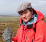
Dr. William Megarry, Queen’s University Belfast
Will Megarry is a landscape archaeologist and lecturer in geographical information science at the School of Natural and Built Environment, Queen’s University Belfast. Originally from Dublin, Ireland, he has worked on projects around the world, exploring how technology can be utilised to manage and protect World Heritage. He is a member of ICOMOS Ireland, an expert member of the International Committee on Archaeological Heritage Management (ICAHM), and has recently been exploring how climate change and cultural heritage intersect. He is currently visiting the Carleton Immersive Media Studio at Carleton University on an Association of Canadian Studies fellowship, exploring Ulster Heritage in Canada.
At this year’s meeting of the World Heritage Committee, over 30 new natural and cultural sites were inscribed on the World Heritage List. This process reflects the significance of these places as global heritage of outstanding universal value, and their inscription can have a significant impact on the economies of communities and countries. The inscription process takes many years or even decades, and the monitoring and protection of these sites is an ongoing and challenging process. Increasingly, World Heritage Sites are under threat from a range of factors. As the number of tourists increase globally, overcrowding and large numbers of visitors are leading to unsustainable development and are threatening the integrity and enjoyment of sites. Global tourism is also a major contributor to greenhouse gas emissions and global warming, and World Heritage Sites play a significant role in this industry. Rising sea levels, increased storminess, desertification and increased rainfall are already impacting many World Heritage Sites, and the problem is only going to get worse. Using examples from Ireland, Peru, Tanzania and India, this talk will explore the range of ways that geospatial technologies and non-invasive techniques can be used to inventory, manage and protect cultural World Heritage Sites.