Abstract: A method for separating an archaeological palimpsest into gender-based activities is of interest to all archaeologists because it enhances our study of ancient human behavior.
Keywords: Palimpsest, gender-based activity, archaeological interpretation, algorithm, Rangifer,knapping, marrow, hide
An archaeological palimpsest is a seemingly random, dense and confusing accumulation of living debris scattered over a surface or buried floor over time. Palimpsests created from accumulated constant use or repeated seasonal use of an archaeological site are often ignored because of the difficulty separating their components. We present a technique for recognizing, dissecting and interpreting these components. Members of my project customized a free web-based program to separate gender-based tools in activity areas in Rangifer hunting sites by type, material, colour and traits. A second method using an algorithmic crawler function authenticated our first method.
Mobility was central in Canadian Barrenland prehistory, where summer sites were occupied for only a few weeks and winter sites, at most, several months. I address this paper to those of you with palimpsest problems, not just seasonal sites but also permanent camps, and begin by locating my study area in northern Canada. Here, four 600-1000km long Barrenland Rangifer ranges of southern forest and northern tundra overlap four hunting territories (Figure 1).
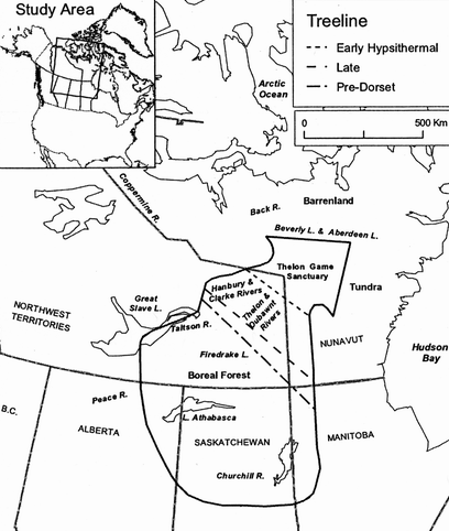
Figure 1. Study area in north-central mainland Canada
The central territory or Beverly range extends from north Saskatchewan to its calving ground at Beverly Lake. Its 1002 hunting camps of all four Barrenland traditions span the past 8,000 years, based on 100 radiocarbon dates. The human yearly cycle closely interlinks with the migration of the caribou, as they move to and from remote, high, dry and windy calving grounds in the northeast. Both hunter and herd were simultaneously either on the summer tundra, at the autumn treeline or in the winter forest. For a week or two in summer both were present at water crossings. Of the four ranges the Beverly range has the largest number and widest distribution of sites in its Middle Talthelei phase because it had the greatest range exploitation of all people under a warm stable climate.
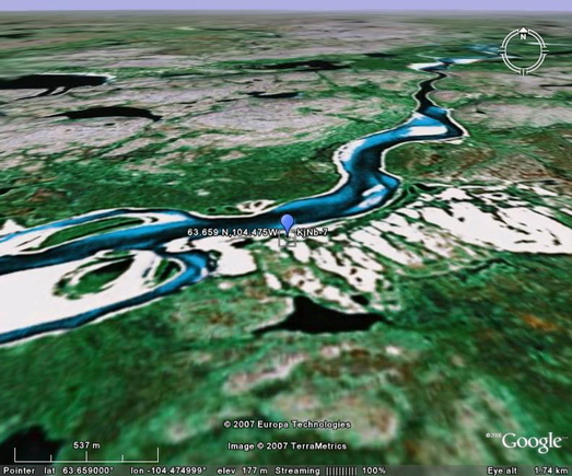
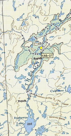
Archaeological site KjNb-7 is a tundra water-crossing camp on the south side of the Thelon River on the shore opposite a huge V-shaped sand blowout (Figure 1, inset top right, circled). Satellite sites, used in those summers when the herd did not cross directly to KjNb-7, are scattered east along the arc-like series of sand blowouts. Sites distances from the river mandated skinning, gutting and quartering of each carcass along its bank. The river also protected KjNb-7 and other camps somewhat from grizzlies and other predators because unwanted guts and hooves, and sometimes the hide, could be thrown into the river and carried away.
KjNb-7 was excavated in July 1976. During its excavation my crew viewed a small sub-herd that had just crossed the river, a harbinger of the thousands of caribou moving over the next few days.
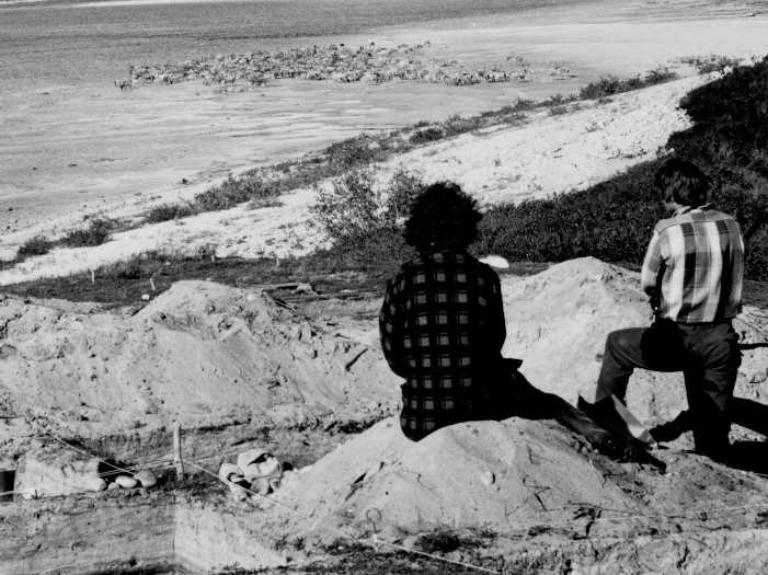
Figure 2. Confirmation KjNb-7 was used seasonally for 6000 years
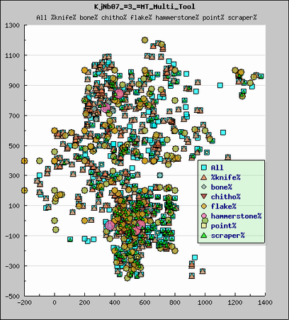
Figure 3. KjNb-7 Middle Taltheilei phase palimpsest
This, plus plentiful caribou bone in all levels, is dramatic proof KjNb-7 was used seasonally since the time of its bottom level dating 6,120 years ago. Continuous use of this site resulted in the forming of palimpsests on all cultural levels, its heaviest in Middle phase dating 1400 to 1800 years ago. Even after removing dozens of kg of flakes, cobbles, charcoal and soil samples and bone and teeth (undepicted in Figure 3), the Middle phase distribution remains a veritable cloud of artifacts. What can we do with this maze? Must we label it a puzzle of skin scrapers, butchering knives and knapping debris? Can we penetrate its depths? Can we sequence its activities?