Tracking southward from high-plains game areas of Wyoming, Athapaskan hunter-groups encountered a challenging landscape. Broad mesas, intersected by deep river canyons, made access to the west difficult. To the east lay the high ridge-line of the Continental Divide. They were adapting to new seasonal patterns in the hunt for new game species, and would make easier progress through the valley bottom-lands that provided forage and water for their prey.
The Athapaskans left few surficial remains, and we can only conjecture how they traversed this eastern edge of the Colorado Plateau to the Four Corners territory. Using modern mapping tools, we have examined satellite imagery, landscape photographs, and 1:250 000 USGS topographic maps to best determine optimal routes for the Athapaskans’ exploration on foot. Not surprisingly, today’s highways throughout western Colorado follow a significant portion of these corridors.
Passageway from Wyoming Basin route

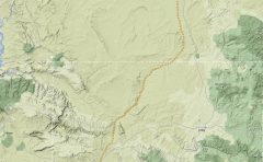
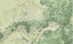
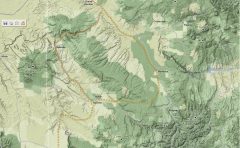
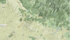
Terrain Mapbase images © GOOGLE – Map data © NAVTEQ tm