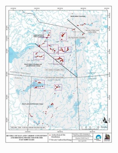
Below is a detailed map of the sites and the geographic reference-points used throughout our Website. Key to the database record of each site is a unique name (e.g. KjNb-07) that translates into a locational reference point. This “Borden Name” is a Canadian system adopted by researchers to name and group archaeological sites. Its alphabetic part narrows the area of the site to an approximate 4×4 km area, its numeric part being the order of reporting the sites. For further explanation, click on this information page.
For more detailed maps and imagery of site complexes (e.g. Firedrake Cluster), mouse-click in the purple-outlined area on the map.
Visit our section on Site Descriptions for more facts, diagrams, and photos of the major stratified sites.
The subsequent analyses of artifacts uncovered at these sites has stimulated much scientific interest and discussion. It is my Team’s hope that the material we present on this Website will attract further comment.