Beyond Topography: Building a Multiliterate Map Collection at the Carleton University Library
By Martha Attridge Bufton (MA, MLIS)
“Map collection” is a misleading term, at least in the context of 21st-century academic libraries: it suggests a group of materials defined by a single form of data visualization, i.e., a diagram that accurately describes the topography or physical features of a geographic location. Today, scholars define mapping and maps more broadly as powerful forms of storytelling.
At the Carleton University Library, this new understanding translates into a “multiliterate” cartography collection that reflects diverse ways of knowing and being in the world. As cartographic specialist Sherri Sunstrum explains, the library team provides access to “a complementary set of sources” and teaching programs that enable faculty and students to ask and answer questions that tell an ever-evolving range of multidisciplinary, multifaceted stories.
Going With the Floe: Collecting a Variety of Mapping Resources
Cabinets have long been a symbol of traditional map collecting. Heavy, rectangular, and large, these metal storage units are designed to house large-scale maps in a series of shallow drawers and occupy a significant footprint in library spaces. Today, Carleton scholars can still easily browse the over 40 cabinets on the first floor of the library, which hold over 150,000 sheet maps and display a multidimensional set of globes.
At a time when many of us may be inclined to define maps as GPS-generated routes on our cell phone screens, maintaining a collection of print maps may seem to be a counterintuitive scholarly practice. However, as Geography Prof. Peter Pulsifer points out, there is still “an important place for paper maps” in academic teaching and research.
In an age of “data deluge,” where researchers have to manage a never-ending stream of geospatial and other data, he believes that paper has advantages. “Even though we have wonderful digital formats, screens, phones, it is very difficult to replace paper maps in terms of flexibility, dimensions, etc.,” he explains. Plus, sometimes we can all experience digital glitches, and “you can roll up a paper map on an ice floe and access information when there is no internet connection.”
Carleton GIS Librarian Rebecca Bartlett agrees that the print map collection is valuable, adding that paper maps widen our view of our physical and social worlds. “The Romans were not tracing their highway systems with GPS. Maps are records of the physical world and also human experiences, and screens can be more difficult to browse than paper. You can see the content of a paper map all at once.”
Carleton has long had a sheet map collection to support teaching and research. In the 1970s, the map cabinets were housed in the Social Sciences Division on the fourth floor of the library. In the 1980s and early 1990s, print maps were found in the central map library in the Loeb Building before being relocated back to the library when the Maps Data, and Government Information (MADGIC) department opened in the 1990s. Sunstrum maintains this collection and has literally touched every map that the library owns. Originally a MADGIC cataloguer, she “fell into” stewarding the map collection and is now passionately committed to the “value and benefits” of these resources, after learning their contents as well as how to “fix up records, discard maps, and instruct on maps.
As with the rest of the Library collections, paper maps and atlases complement many digital forms of sources. Scholars can access numerous online collections and interactive maps via the Library website, many of which are shared on the internet by other institutions. Professional library staff and archivists in Ontario and across Canada collaborate to share their resources. For example, Carleton library staff have worked actively with colleagues in the Ontario Council of University Libraries (OCUL) and other Canadian academic libraries to inventory and digitize historic maps, and these resources are now openly and easily accessible online.
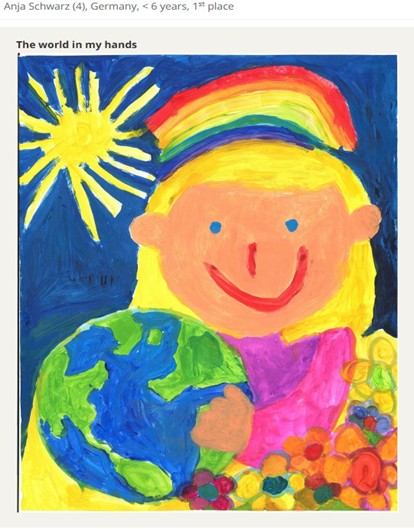
In addition to classic forms of maps produced by professional cartographers, the Carleton Library has supported the collection and sharing of “alternative” forms of maps, such as those drawn by children. Sunstrum has collaborated with academics, including Carleton Prof. Fraser Taylor and independent scholar Dr. Romola Thumbadoo, plus members of the International Cartographic Association (ICA) to share maps from the Barbara Petchnik Children’s Map Competition. The ICA has hosted the competition since 1993 to promote children’s interest and engagement in mapping their world, and the yearly results are available through Carleton’s institutional repository.
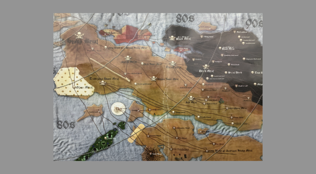
This mixture of “old and new” forms of mapping found in the Carleton Library collection aligns with expanded views of cartography, both as a research methodology and a set of methods.
“A map is only one part of cartographic storytelling,” states Pulsifer. “Now cartographic methods include sharing data via audio and video, photographs, graphs, and other types of diagrams. Each of these media works to combine all things to tell various stories, such as Indigenous stories, demographics, and the history of seismic activity.” A relevant library collection reflects this 21st-century reality.
Deep Learning: Mapping to Transform Our Understanding of the World
In 1995, members of the New London group of scholars argued for a “new approach to literacy pedagogy” that they called multiliteracies[1] Language and text-based teaching did not reflect the needs of students around the world who needed to navigate a world in which they were increasingly exposed to diverse cultures, forms of communication, and technologies. According to these scholars, students needed to be textually, visually, and technically literate if they were to “participate fully in public, community, and economic life.”[2]
This multiliterate view of teaching and learning also aligns with an understanding of maps and mapping as more than a “scientific” approach to visually representing the topography of our physical world and underpins the various Library teaching programs offered to students and faculty using the map collection.
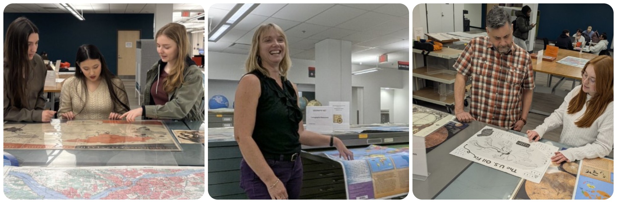
Library staff regularly teach students how to find and “read” maps in map labs. At the beginning of the fall and winter terms, anyone passing through the first floor of the library may encounter groups of undergraduate and graduate students clustered around a set of print maps curated for a particular class.
Adriana Caswell is pursuing a master’s degree in Geography with a focus on Earth systems modelling. Her interest in geomatics and geospatial research was fostered during her undergraduate studies in Geography. She took a course with Peter Pulsifer during which he required students to complete a “library tour” that introduced students to the print map collection and the GIS Lab.
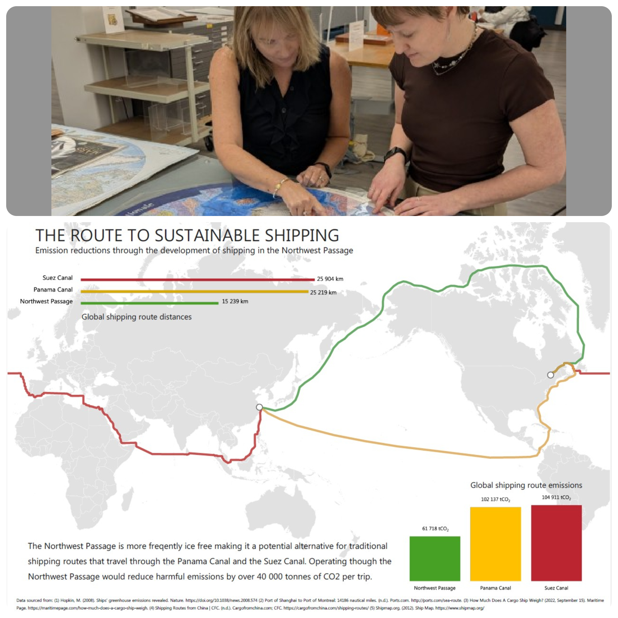
“This was my first time to be introduced to these resources and wish I had known about them earlier,” she says. She began her degree in 2020, which meant studying online during the early years of the COVID pandemic. “I didn’t really have access to anything then and after the tour, I was in love with maps. It was cool to see all of these maps in one place.” In her master’s program, she has returned to the map cabinets for inspiration as she designs data visualizations for her own work. Access to existing maps in the library was an invaluable part of the design process.
“When we started the project, we had to decide how to portray the project on a map. Being able to look at the map that existed in the library allowed us to get inspiration of design elements and data elements that we wanted included and that guided us. Staff in the library laid out the maps for us, so that we could physically see what existed for guidance and inspiration.”
Both Sunstrum and Bartlett are unsurprised that Caswell’s interest and understanding of her discipline could be intensified and even transformed by an opportunity to engage directly with maps.
“The map cabinets are student space,” explains Bartlett. “A space for thinking, discovering useful or perhaps vital information, and learning the value of maps.”
Sunstrum agrees. “GIS data only goes back so far, while print maps used to bridge knowledge gaps.” She conducts many of the teaching sessions with the map collection each year and is noticing that students are coming from a growing range of disciplines, such as geography, Earth Sciences, History, African Studies, Architecture, and Digital Humanities. For example, Dr. Amanda Montague leads a community engaged digital humanities project studying community and social isolation amongst seniors in the Old Ottawa South neighbourhood. She has consulted with Bartlett and her team recently mapped community assets for seniors.
Sunstrum also provides individual assistance to Carleton scholars. She supported Dr. Romola Thumbadoo’s postdoctoral work by setting up a personal map table with a selection of maps that Thumbadoo could study and analyze at her convenience. Sunstrum has also recently worked with an architecture student who is studying Pink Lake and needs data on the geology, topography. and depths of the lake.
As Sunstrum points out, teaching students to use the collection involves more than simply showing them how to do a search in the library’s system or find a print map in a cabinet. Students also need to be encouraged to think critically about maps as being socially and politically constructed, i.e., as sources of human bias.
“We have a very colonial collection,” she says. “For example, it is only recently that certain countries have begun to appear on maps, so our collection shows a very Westernized view of the world.”
And, of course, there is always the reference question that needs a multiliterate strategy for finding relevant sources because there is no clear-cut and easy answer.
“Last term, a student asked to see mappings of trees in the Brazilian rainforest, and I could not give her one,” says Sunstrum. However, Sunstrum’s deep understanding of mapping processes allowed her to help the student find alternative sources that could at least partially answer the research question.
“Topography is supported by government with geologists and topographers, who may have the resources to gather data about tree canopies, but in terms of scale, this data might not identify every tree in the rainforest.”
She was able to direct the student to a wood database that identifies varieties of trees and wood, as well as Wikipedia references that provide some useful information about trees.
Honouring an Outstanding Contribution to Map Librarianship
Sherri Sunstrum’s work on the map collections and programs at Carleton has recently been recognized nationally.
In 2025, the Association of Canadian Map Libraries and Archives (ACMLA) recognized Sunstrum for her outstanding contributions to excellence in map librarianship, which include her work on the association bibliographic committee, communications and conference planning, as well as her “deep commitment to the advancement of geospatial knowledge and a passion for facilitating access to cartographic information”, as demonstrated by her teaching and collections work at Carleton.
Co-nominator Francine Berish (Map Librarian, Queen’s University) is very pleased that Sunstrum has been awarded this honour. As she explains, Sunstrum is known as a steadfast and generous colleague who cares deeply about the people with whom she works as well as the integrity and advancement of cartography and geographic information.
“We work on many projects related to print collections, to describe, to discover, to digitize, which can only be completed collaboratively with specialists at institutions working across geographies,” says Berish. “We have benefited from Sherri’s contributions over the years, particularly when discussing collections projects. Not everyone can be present on issues, but we always hear from Sherri.”
About the author
Martha Attridge Bufton (MA History, MLIS) is the Interdisciplinary Studies Librarian in Research Support Services at the Carleton University Library. Her research interests in library and information science include digital humanities and game-based learning. As a historian, she researches in the areas of labour and women’s history.
[1] Cazden, Courtney, Bill Cope, Norman Fairclough, and Jim Gee. “A pedagogy of multiliteracies: designing social futures,” Harvard Educational Review, 66, no. 1 (1996): 60–92. https://doi.org/10.17763/haer.66.1.17370n67v22j160u
[2] Cazden, Cope, Fairclough, and Gee, “A pedagogy of multiliteracies,” p. 60.