Fraser Taylor
Chancellor’s Distinguished Research Professor of International Affairs Geography and Environmental Studies
- B459 Loeb Building, Carleton University
- 1125 Colonel By Drive, Ottawa, ON, K1S 5B6
- Email Fraser Taylor
Chancellor’s Distinguished Research Professor of International Affairs Geography and Environmental Studies
Director, Geomatics and Cartographic Research Center (GCRC)
(Geomatics Technologies, Geospatial Information Management, Interoperability, Environmental Monitoring with Indigenous People, Traditional Knowledge)
Biography
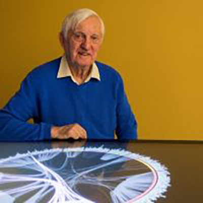
Dr. D. R. Fraser Taylor is the Chancellor’s Distinguished Research Professor of International Affairs, Geography and Environmental Studies, and Director of the Geomatics and Cartographic Research Centre at Carleton University, Ottawa, Canada. He is recipient of the Killam Prize for the Social Sciences, Canada’s highest academic honour (2014), which was accompanied by an award in the amount of $100,000; the Carl Mannerfelt Gold Award, the International Cartographic Association’s most prestigious acknowledgement and first presentation to a Canadian (2013); and the 3M/Royal Canadian Geographic Society Award for Environmental Innovation (2012). In 2008 he was elected a Fellow of the Royal Society of Canada. Dr. Taylor is active in geospatial information management research and is a member of the United Nations Expert Group on Global Geospatial Information Management. He was President of the International Cartographic Association for two four-year terms, President of the International Union for Surveys and Mapping, and Chair the International Steering Committee for Global Mapping for a decade. He was Secretary-Treasurer of the Canadian Association of African Studies for fifteen years and received an Honorary Life Membership in the Association for his services to African scholarship.
He is recognized as one of the world’s leading cartographers, is a pioneer in the use of the computer in cartography and in the creation of digital atlases, and he introduced the concept of cybercartography; he has a strong background in international development, supporting the use of geographical information processing, cartography and cybercartography with local communities, governments and academic institutions across Canada, and in Africa, India, Denmark, Norway, China, Mexico and Brazil; Dr. Taylor also works extensively with Indigenous communities (Inuit and First Nations) in the creation of cybercartographic atlases dealing with traditional and local knowledge. He has published widely in this field and has served as editor for many books. His earlier books on Cybercartography are entitled Cybercartography: Theory and Practice (Elsevier 2005) and Developments in the Theory and Practice of Cybercartography: Applications and Indigenous Mapping (Elsevier 2014). Two new volumes Further Development in the Theory and Practice of Cybercartography: International Dimensions and Language Mapping and Cybercartography in a Reconciliation Community: Engaging Intersecting Perspectives were published In September and October of 2019.
His current academic research interests include Cybercartography, International Development, Environment, Indigenous Knowledge and Development, Arctic Policies, Education and Development and Canada’s Official Development Assistance policies and programs.
Research Interests
Professor Taylor’s main research interests lie in the application of geospatial information management to the analysis of key socio-economic problems in a national and international context and the presentation of the results in innovative new cartographic forms. He introduced and continues to develop the new paradigm of cybercartography. His interests in cartography and international development issues are often inter-related. He has extensive field experience in developing nations, especially in Africa; this includes a six-year period as an education officer in rural Kenya where he completed his Ph.D. thesis on Rural Development in Muranga District. His research interests in this area include development studies with special reference to Africa, China and Latin America; regional and rural development theory and practice, sustainable development and Indigenous development strategies; technology transfer in the field of geomatics; Canada’s international policies in overseas development assistance; and technology transfer.
Memberships
Secretary-Treasurer of the Canadian Association of African Studies for fifteen years
Served two terms as President of the Canadian Cartographic Association.
Chaired the Social and Human Services Committee of the Canadian Commission for UNESCO
Member of the editorial boards for several learned journals.
Vice President of the International Cartographic Association (ICA) from 1984-97, President from 1987-1995 and Past-President in 1996.
President of the International Union for Surveys and Mapping from 1989 to 1993.
Member of the GEOSS Task Force on Data Sharing
Member of Open Geospatial Consortium (OGC) Global Advisory Council
Chair, International Steering Committee for Global Mapping, 2003-2013
Member, CODATA Working Group on Data at Risk
Member of the United Nations Committee of Experts on Geospatial Information Processing
Awards/Honours
2014 Awarded Killam Prize for the Social Sciences. This is one of the most prestigious national awards given in Canada, and it included an award of $100,000.
2013 Awarded the Carl Mannerfelt Gold Medal by the International Cartographic Association (ICA) at the August 29 Plenary Session of the ICA Conference in Dresden. This highest award of ICA honours cartographers of outstanding merit who have made significant contributions of an original nature to the field of cartography.
2012 Received the Canadian Award for Environmental Innovation from The Royal Canadian Geographical Society and 3M Canada which recognizes outstanding individuals in business, government, academia or community organizations whose innovative contributions to environmental change benefit Canada and Canadians.
2008 Certificate of Recognition and Appreciation for Contributions to the Development of Geomatics in Mexico presented by Centro de Investigacion en Geografia y Geomatics “Ing. Jorge L. Tamayo”, A.C., CONACYT, Mexico City
2008 Appointed Fellow of the Royal Society of Canada
2006 Award of Distinction Canadian Cartographic Association for exceptional Contributions to Cartographic Scholarship
1999 Awarded an Honorary Degree in the Humanities by the Pontifica Universidad Catolica del Peru, Lima, Peru in recognition of “outstanding academic achievements and notable personal qualities”
1994 Awarded Honorary Degree, University of Trujillo, Peru in recognition of “a distinguished academic career and services to the nation”
1988 Honorary Life Membership, Canadian Association of African Studies
Current Research
Current research is focused on the use of cybercartography and the innovative NUNALIIT cybercartographic data management platform to produce a series of atlases on a wide variety of topics, especially in cooperation with Indigenous communities. This includes exploring a range of issues dealing with Traditional Knowledge, including legal and ethical considerations. Dr. Taylor has received over $14 million in research funding for this work from a variety of sources including SSHRC, CFI, CEC-NAPECA, INAC, the Ontario Research Fund, The Ontario Brain Institute, the Government of Nunavut, and a number of Northern Communities and Organizations including Inuit Tapiriit Kanatami, Kitikmeot Heritage Society, Clyde River, Sahtu and Gwich’in. This support is ongoing and current funded projects include:
A SSHRC partnership development grant to transfer cybercartographic theory and practice to communities and organizations in Mexico, Brazil and Denmark. Support for this project has also been provided by CEC-NAPECA.
Participation in a CFI funded project as part of the Canadian Consortium for Arctic Data Interoperability on data sharing and analysis for Arctic Research and Northern Communities
The Nunaliit Coastal Research Inventory Atlas (Government of Nunavut)
The continuing development of the Thule Atlas with the Kitikmeot Heritage Society (KHS)
The continuing development of a mapping and visualization platform for the research networks of the Ontario Brain Institute (OBI)
The Residential Schools Land Memory Mapping Project (SSHRC Insight Grant)
Participation in the Ocean Canada Partnership, Arctic Working Group (UBC, SSHRC)
Mapping Linguistic Variation on the Canadian Prairies (University of Manitoba, SSHRC)
The Indigenous Community Based Climate Monitoring Program (INAC)
Enabling NUNALIIT to support the Atlas Cine Platform (Concordia University and CANARIE)
Pan-Arctic Observing: Meeting Societal Needs for Arctic Observational Data and Information. New Frontiers in Research Fund
Arctic Passion. Alfred Wegener Institute/Arctic Institute. Horizon 2020
Many new projects are under development in this new domain of Cybercartography.
[cu_shortcodes_buttons title=”View Recent Publications” url=”https://carleton.ca/npsia/people/fraser-taylor-3/” target=”true” /]