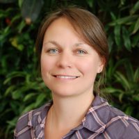
Assistant Professor Koreen Millard
Multi-sensor data fusion for improved understanding of hydrology/vegetation change and interactions; Modelling spatial and temporal biophysical variables with time-series remote sensing and field-measurements; Machine learning image classification for mapping environmental change
| Degrees: | B.A. (Bishop's University), M.Sc. (Acadia University), Ph.D. (Carleton) |
| Phone: | 613-520-2600 x 2566 |
| Email: | koreenmillard@cunet.carleton.ca |
| Office: | A301D Loeb Building |
Biography
My research sits at a crossroads between geomatics, physical geography and big data science. I focus on ecosystem monitoring and extraction of biophysical parameters from remotely sensed imagery, but I also critically assess how bias and uncertainty can affect the use of these tools in a variety of landscapes. By coupling remote sensing with extensive monitoring in the field, my research helps detangle hydrological, vegetation and climate interactions so that we can better predict the responses of wetlands and northern ecosystems to change. Recently, much of my research has been related to peatland wildfires, including assessing time series analysis techniques of SAR and multispectral imagery to understand the conditions under which peatlands burn.
2024 – 2025 Courses
- GEOM 4001 Fall – Field Studies in Remote Sensing
- GEOM 4003 Winter – Remote Sensing of the Environment
- GEOG 5804 Fall – Introduction to GIS
Selected Publications:
Pontone, N., Millard, K., Guindon, L., Thompson, D., Beaudoin, A., (2024). A hierarchical, multi-sensor framework for peatland sub-class and vegetation mapping throughout the Canadian Boreal Forest. Remote Sensing In Ecology and Conservation. https://doi.org/10.1002/rse2.384
Pelletier, N., Millard, K., Darling, S., (2023). Wildfire probability estimation in Canadian treed peatlands based on remote-sensing time-series of surface conditions. Remote Sensing of Environment. 296, https://doi.org/10.1016/j.rse.2023.113747.
Schultz, S., Millard, K., Darling, S., Chenier, R., (2023). “Investigating the Use of Sentinel-1 for Improved Mapping of Small Peatland Water Bodies: Towards Wildfire Susceptibility Monitoring in Canada’s Boreal Forest”. Hydrology, 10(5), 102, https://doi.org/10.3390/hydrology10050102.
Millard, K., Darling, S., Pelletier, N., Schultz., S., (2022). Seasonally-decomposed Sentinel-1 backscatter time-series are useful indicators of peatland wildfire vulnerability. Remote Sensing of Environment. 283(15), https://doi.org/10.1016/j.rse.2022.113329.
Antropova, Y., Komarov, A., Richardson, M., Millard, K., Smith, K., (2022). Detection of wet snow in the Arctic tundra from time-series fully-polarimetric RADARSAT-2 images. Remote Sensing of Environment, https://doi.org/10.1016/j.rse.2022.113305.
Riva, F., Martin, C., Millard, K., Fahrig, L., (2022). Loss of the world’s smallest forests. Global Change Biology, https://doi.org/10.1111/gcb.16449.
Fuller, A., Millard, K., Green, J., (2022), SatViT: Pre-training Transformers for Earth Observation. IEEE Geoscience and Remote Sensing Letters, 19, https://doi.org/10.1109/LGRS.2022.3201489.
Melton, J., Chan, E., Millard, K., Fortier, M., R. Winton, S., Martín-López, J., Cadillo-Quiroz, H., Kidd, D., and Verchot, L., (2022), A map of global peatland extent created using machine learning (Peat-ML). Geoscientific Modelling and Development, 15, 4709–4738, https://doi.org/10.5194/gmd-15-4709-2022.
Millard, K., Brown, N., Stiff, D., Pietroniro, A., (2020). Automated surface water detection from space: a Canada-wide, open-source, automated, near-real time solution. Canadian Journal of Water Resources. 45(5), 304-323. https://doi.org/10.1080/07011784.2020.1816499
Millard, K., Kirby, P., Nandall, S., Benhamian, A., Banks, S., Pacini, F., (2020). Using Growing-Season Time Series Coherence for Improved Peatland Mapping: Comparing the Contributions of Sentinel-1 and RADARSAT-2 Coherence in Full and Partial Time Series. Remote Sensing, 12(15), 2465, https://doi.org/10.3390/rs12152465.
For the most up-to list of my research publications, please visit my google scholar profile here