
417 St. Patrick’s Building, Carleton University
We have a reduction of the Campus Map below, but the official University page with the Carleton campus map is here: http://carleton.ca/campus/ and a PDF downloadable version here .
Parking lot 6 (P6, top centre) is located the closest to St. Patrick’s Building (SP).
Rates: http://carleton.ca/parking/visitors/parking-rates/
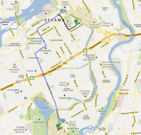
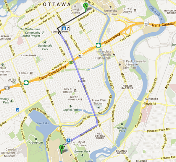
OCTranspo buses to Carleton University:
#7 Carleton (from downtown, see route map below)
#4 Hurdman/Rideau Centre (from downtown, see route map below)
#111 Baseline (from the south/west end of the city)
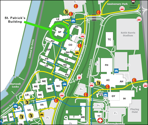
The St. Patrick’s Building (SP) is located within the “residence precinct,” surrounded by Leeds (LE), Stormont-Dundas (SD), Russell (RU), and the University Commons (CO) buildings.
OC Transpo bus stops are nearby on Campus Avenue (close to SD and MC), and a taxi stand is located between Leeds (LE) and Stormont-Dundas (SD).
The entrance to campus is at the intersection of Bronson and Sunnyside, at the top right of the map (above).
Some visual points of reference include: the 23-storey Dunton Tower (DT) which is shown in the lower left corner, and the ten-storey Glengarry (GH) residence attached to the University Commons (CO).
Please beware that there is a great deal of construction going on around the parking lots P6 and P7 beside the bridge over the train tracks. Although the parking lots are still accessible to vehicles they are currently not exactly as shown on the campus map. Signage to direct you to the parking lots is in place.
===================================
OC Transpo Bus Route #4
OC Transpo Bus Route #7
===================================